You are here: Home > Network List > G - GEOSCOPE Stations List
> Station INU Inuyama, Japan > Earthquake Result Viewer
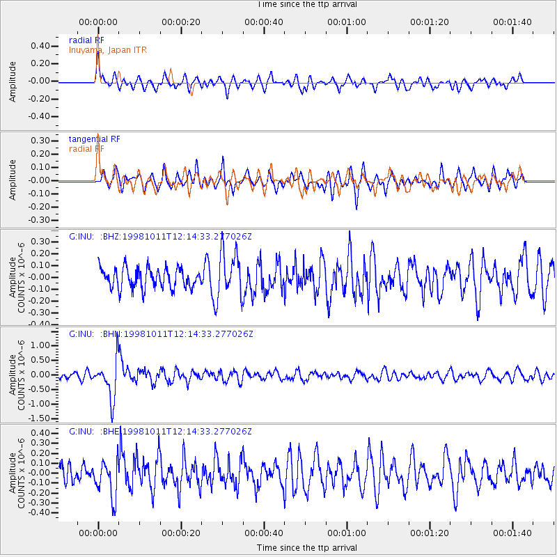
INU Inuyama, Japan - Earthquake Result Viewer
*The percent match for this event was below the threshold and hence no stack was calculated.
| Earthquake location: |
Fiji Islands Region |
| Earthquake latitude/longitude: |
-21.0/-179.1 |
| Earthquake time(UTC): |
1998/10/11 (284) 12:04:54 GMT |
| Earthquake Depth: |
624 km |
| Earthquake Magnitude: |
5.9 UNKNOWN, 5.4 MB, 5.9 MW |
| Earthquake Catalog/Contributor: |
WHDF/NEIC |
|
| Network: |
G GEOSCOPE |
| Station: |
INU Inuyama, Japan |
| Lat/Lon: |
35.35 N/137.03 E |
| Elevation: |
132 m |
|
| Distance: |
69.8 deg |
| Az: |
322.88 deg |
| Baz: |
136.401 deg |
| Ray Param: |
$rayparam |
*The percent match for this event was below the threshold and hence was not used in the summary stack. |
|
| Radial Match: |
65.50939 % |
| Radial Bump: |
400 |
| Transverse Match: |
61.76971 % |
| Transverse Bump: |
391 |
| SOD ConfigId: |
4480 |
| Insert Time: |
2010-02-26 23:22:52.816 +0000 |
| GWidth: |
2.5 |
| Max Bumps: |
400 |
| Tol: |
0.001 |
|
Signal To Noise
| Channel | StoN | STA | LTA |
| G:INU: :BHN:19981011T12:14:33.277026Z | 7.392399 | 6.9326245E-7 | 9.378044E-8 |
| G:INU: :BHE:19981011T12:14:33.277026Z | 1.5314418 | 1.9076923E-7 | 1.2456839E-7 |
| G:INU: :BHZ:19981011T12:14:33.277026Z | 2.2297707 | 1.8736272E-7 | 8.4027796E-8 |
| Arrivals |
| Ps | |
| PpPs | |
| PsPs/PpSs | |


