ULM LAC DU BONNET, MB, CANADA - Earthquake Result Viewer
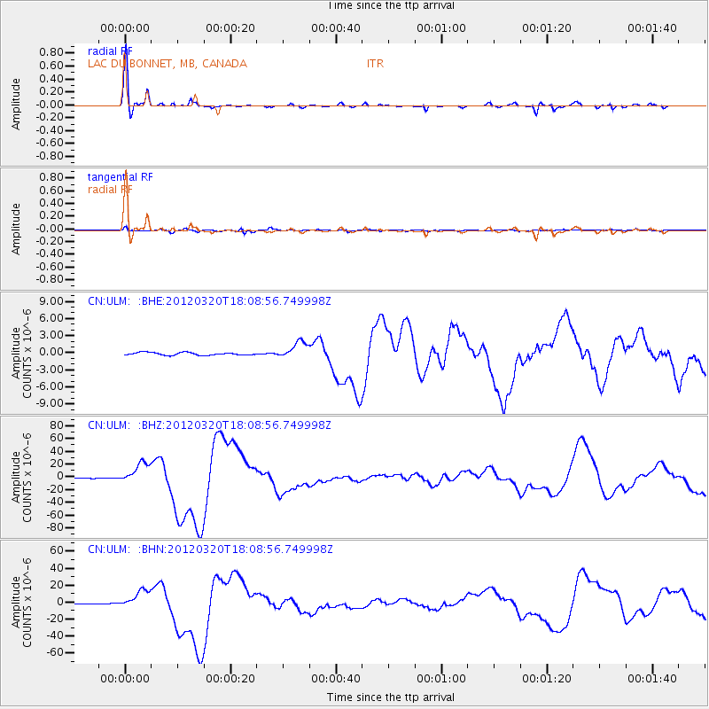
Earthquake location: Near Coast Of Guerrero, Mexico
Earthquake latitude/longitude: 16.5/-98.2
Earthquake time(UTC): 2012/03/20 (080) 18:02:47 GMT
Earthquake Depth: 20 km
Earthquake Magnitude: 6.6 MB, 7.6 MS, 7.4 MW, 7.4 MW
Earthquake Catalog/Contributor: WHDF/NEIC
Network: CN Canadian National Seismograph Network
Station: ULM LAC DU BONNET, MB, CANADA
Lat/Lon: 50.25 N/95.87 W
Elevation: 251 m
Distance: 33.7 deg
Az: 2.724 deg
Baz: 184.073 deg
Ray Param: 0.07805372
Estimated Moho Depth: 30.75 km
Estimated Crust Vp/Vs: 1.83
Assumed Crust Vp: 6.459 km/s
Estimated Crust Vs: 3.525 km/s
Estimated Crust Poisson's Ratio: 0.29
Radial Match: 94.94827 %
Radial Bump: 264
Transverse Match: 86.41426 %
Transverse Bump: 368
SOD ConfigId: 440406
Insert Time: 2012-06-03 02:28:56.557 +0000
GWidth: 2.5
Max Bumps: 400
Tol: 0.001

Signal To Noise

ChannelStoNSTALTA
CN:ULM: :BHZ:20120320T18:08:56.749998Z52.6767851.6982573E-53.22392E-7
CN:ULM: :BHN:20120320T18:08:56.749998Z49.2275731.1083101E-52.2514008E-7
CN:ULM: :BHE:20120320T18:08:56.749998Z6.35826061.4929371E-62.3480277E-7
Arrivals
Ps4.3 SECOND
PpPs12 SECOND
PsPs/PpSs17 SECOND