LLLB LILLOOET, BC, CANADA ADA - Earthquake Result Viewer
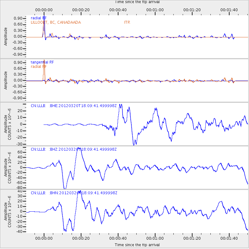
Earthquake location: Near Coast Of Guerrero, Mexico
Earthquake latitude/longitude: 16.5/-98.2
Earthquake time(UTC): 2012/03/20 (080) 18:02:47 GMT
Earthquake Depth: 20 km
Earthquake Magnitude: 6.6 MB, 7.6 MS, 7.4 MW, 7.4 MW
Earthquake Catalog/Contributor: WHDF/NEIC
Network: CN Canadian National Seismograph Network
Station: LLLB LILLOOET, BC, CANADA ADA
Lat/Lon: 50.61 N/121.88 W
Elevation: 700 m
Distance: 39.0 deg
Az: 336.025 deg
Baz: 142.278 deg
Ray Param: 0.07522469
Estimated Moho Depth: 24.75 km
Estimated Crust Vp/Vs: 1.85
Assumed Crust Vp: 6.597 km/s
Estimated Crust Vs: 3.566 km/s
Estimated Crust Poisson's Ratio: 0.29
Radial Match: 92.43526 %
Radial Bump: 313
Transverse Match: 67.63218 %
Transverse Bump: 400
SOD ConfigId: 440406
Insert Time: 2012-06-03 02:29:10.400 +0000
GWidth: 2.5
Max Bumps: 400
Tol: 0.001

Signal To Noise

ChannelStoNSTALTA
CN:LLLB: :BHZ:20120320T18:09:41.499998Z6.5590088.602166E-61.3115042E-6
CN:LLLB: :BHN:20120320T18:09:41.499998Z4.01091344.244815E-61.0583163E-6
CN:LLLB: :BHE:20120320T18:09:41.499998Z3.5141872.5631277E-67.2936575E-7
Arrivals
Ps3.4 SECOND
PpPs9.9 SECOND
PsPs/PpSs13 SECOND