KHC CZ.KHC - Earthquake Result Viewer
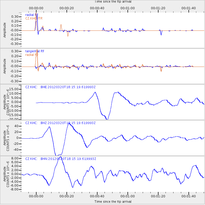
Earthquake location: Near Coast Of Guerrero, Mexico
Earthquake latitude/longitude: 16.5/-98.2
Earthquake time(UTC): 2012/03/20 (080) 18:02:47 GMT
Earthquake Depth: 20 km
Earthquake Magnitude: 6.6 MB, 7.6 MS, 7.4 MW, 7.4 MW
Earthquake Catalog/Contributor: WHDF/NEIC
Network: CZ Czech Regional Seismic Network
Station: KHC CZ.KHC
Lat/Lon: 49.13 N/13.58 E
Elevation: 700 m
Distance: 91.2 deg
Az: 37.587 deg
Baz: 297.012 deg
Ray Param: 0.041615695
Estimated Moho Depth: 32.75 km
Estimated Crust Vp/Vs: 1.78
Assumed Crust Vp: 6.276 km/s
Estimated Crust Vs: 3.531 km/s
Estimated Crust Poisson's Ratio: 0.27
Radial Match: 99.0863 %
Radial Bump: 260
Transverse Match: 90.35869 %
Transverse Bump: 400
SOD ConfigId: 440406
Insert Time: 2012-06-03 02:29:25.134 +0000
GWidth: 2.5
Max Bumps: 400
Tol: 0.001

Signal To Noise

ChannelStoNSTALTA
CZ:KHC: :BHZ:20120320T18:15:19.619993Z13.2733773.8194603E-62.8775347E-7
CZ:KHC: :BHN:20120320T18:15:19.619993Z2.60648374.7291425E-71.8143764E-7
CZ:KHC: :BHE:20120320T18:15:19.619993Z5.4891451.2142118E-62.2120236E-7
Arrivals
Ps4.1 SECOND
PpPs14 SECOND
PsPs/PpSs18 SECOND