You are here: Home > Network List > G - GEOSCOPE Stations List
> Station INU Inuyama, Japan > Earthquake Result Viewer
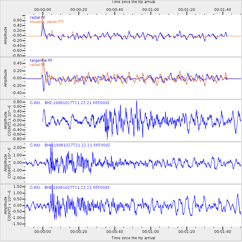
INU Inuyama, Japan - Earthquake Result Viewer
*The percent match for this event was below the threshold and hence no stack was calculated.
| Earthquake location: |
Halmahera, Indonesia |
| Earthquake latitude/longitude: |
2.9/128.6 |
| Earthquake time(UTC): |
1998/10/27 (300) 21:16:21 GMT |
| Earthquake Depth: |
61 km |
| Earthquake Magnitude: |
5.9 MB, 5.9 UNKNOWN, 5.9 MW |
| Earthquake Catalog/Contributor: |
WHDF/NEIC |
|
| Network: |
G GEOSCOPE |
| Station: |
INU Inuyama, Japan |
| Lat/Lon: |
35.35 N/137.03 E |
| Elevation: |
132 m |
|
| Distance: |
33.2 deg |
| Az: |
12.607 deg |
| Baz: |
195.466 deg |
| Ray Param: |
$rayparam |
*The percent match for this event was below the threshold and hence was not used in the summary stack. |
|
| Radial Match: |
72.23758 % |
| Radial Bump: |
400 |
| Transverse Match: |
66.12676 % |
| Transverse Bump: |
400 |
| SOD ConfigId: |
4480 |
| Insert Time: |
2010-02-26 23:22:55.083 +0000 |
| GWidth: |
2.5 |
| Max Bumps: |
400 |
| Tol: |
0.001 |
|
Signal To Noise
| Channel | StoN | STA | LTA |
| G:INU: :BHN:19981027T21:22:21.665009Z | 2.9799016 | 5.801677E-7 | 1.9469358E-7 |
| G:INU: :BHE:19981027T21:22:21.665009Z | 1.2162243 | 2.4621562E-7 | 2.0244259E-7 |
| G:INU: :BHZ:19981027T21:22:21.665009Z | 1.1261421 | 1.7001985E-7 | 1.5097548E-7 |
| Arrivals |
| Ps | |
| PpPs | |
| PsPs/PpSs | |


