
CLF Chambon la Foret observatory, France - Earthquake Result Viewer
| ||||||||||||||||||
| ||||||||||||||||||
| ||||||||||||||||||
|
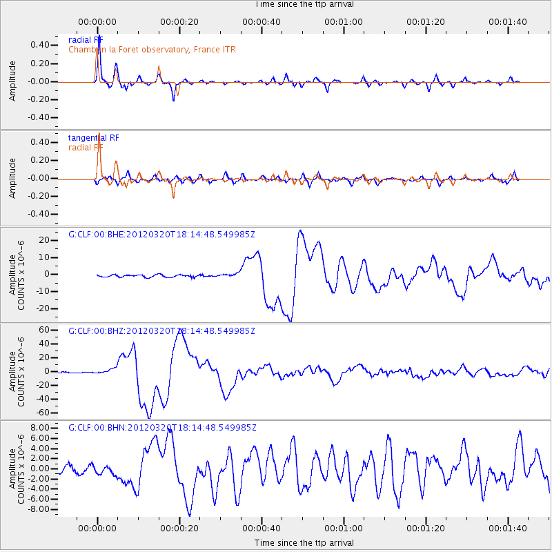
Signal To Noise
| Channel | StoN | STA | LTA |
| G:CLF:00:BHZ:20120320T18:14:48.549985Z | 8.204682 | 4.3243326E-6 | 5.270566E-7 |
| G:CLF:00:BHN:20120320T18:14:48.549985Z | 1.285262 | 8.089479E-7 | 6.294031E-7 |
| G:CLF:00:BHE:20120320T18:14:48.549985Z | 1.7513503 | 1.187735E-6 | 6.7818246E-7 |
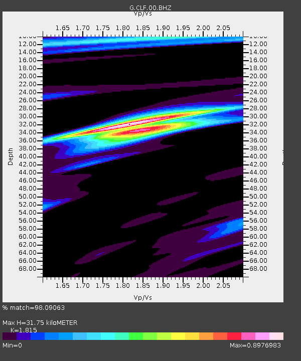
| Arrivals | |
| Ps | 4.3 SECOND |
| PpPs | 14 SECOND |
| PsPs/PpSs | 19 SECOND |

