
IVI Ivittuut, Greenland - Earthquake Result Viewer
| ||||||||||||||||||
| ||||||||||||||||||
| ||||||||||||||||||
|
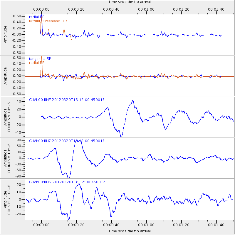
Signal To Noise
| Channel | StoN | STA | LTA |
| G:IVI:00:BHZ:20120320T18:12:00.45001Z | 6.551076 | 1.1850348E-5 | 1.8089162E-6 |
| G:IVI:00:BHN:20120320T18:12:00.45001Z | 3.153051 | 3.659361E-6 | 1.1605779E-6 |
| G:IVI:00:BHE:20120320T18:12:00.45001Z | 3.1921272 | 5.3223785E-6 | 1.6673454E-6 |
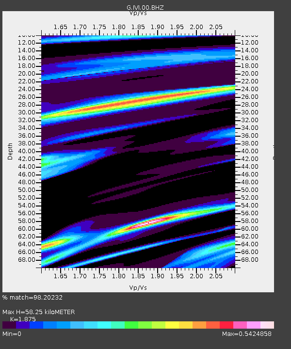
| Arrivals | |
| Ps | 8.3 SECOND |
| PpPs | 25 SECOND |
| PsPs/PpSs | 33 SECOND |

