You are here: Home > Network List > G - GEOSCOPE Stations List
> Station INU Inuyama, Japan > Earthquake Result Viewer
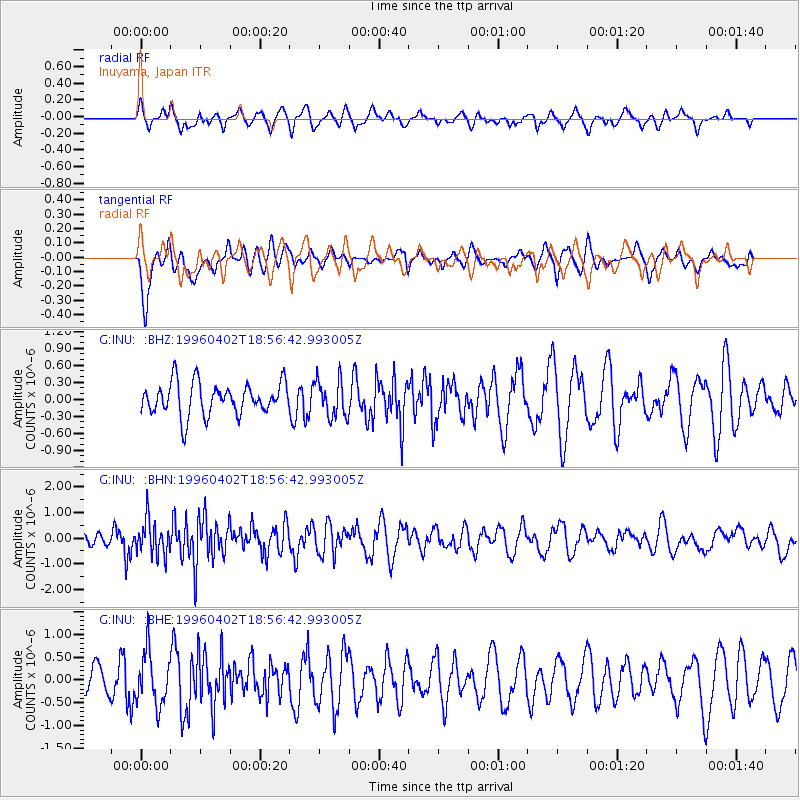
INU Inuyama, Japan - Earthquake Result Viewer
*The percent match for this event was below the threshold and hence no stack was calculated.
| Earthquake location: |
Talaud Islands, Indonesia |
| Earthquake latitude/longitude: |
3.1/126.3 |
| Earthquake time(UTC): |
1996/04/02 (093) 18:50:36 GMT |
| Earthquake Depth: |
41 km |
| Earthquake Magnitude: |
5.7 MB, 5.4 MS, 5.9 UNKNOWN, 5.6 MW |
| Earthquake Catalog/Contributor: |
WHDF/NEIC |
|
| Network: |
G GEOSCOPE |
| Station: |
INU Inuyama, Japan |
| Lat/Lon: |
35.35 N/137.03 E |
| Elevation: |
132 m |
|
| Distance: |
33.6 deg |
| Az: |
15.968 deg |
| Baz: |
199.637 deg |
| Ray Param: |
$rayparam |
*The percent match for this event was below the threshold and hence was not used in the summary stack. |
|
| Radial Match: |
52.77266 % |
| Radial Bump: |
400 |
| Transverse Match: |
52.393963 % |
| Transverse Bump: |
400 |
| SOD ConfigId: |
4480 |
| Insert Time: |
2010-02-26 23:22:55.947 +0000 |
| GWidth: |
2.5 |
| Max Bumps: |
400 |
| Tol: |
0.001 |
|
Signal To Noise
| Channel | StoN | STA | LTA |
| G:INU: :BHN:19960402T18:56:42.993005Z | 2.1134238 | 6.7144344E-7 | 3.1770412E-7 |
| G:INU: :BHE:19960402T18:56:42.993005Z | 1.4407259 | 5.8437877E-7 | 4.056141E-7 |
| G:INU: :BHZ:19960402T18:56:42.993005Z | 1.1618054 | 3.3155328E-7 | 2.853776E-7 |
| Arrivals |
| Ps | |
| PpPs | |
| PsPs/PpSs | |


