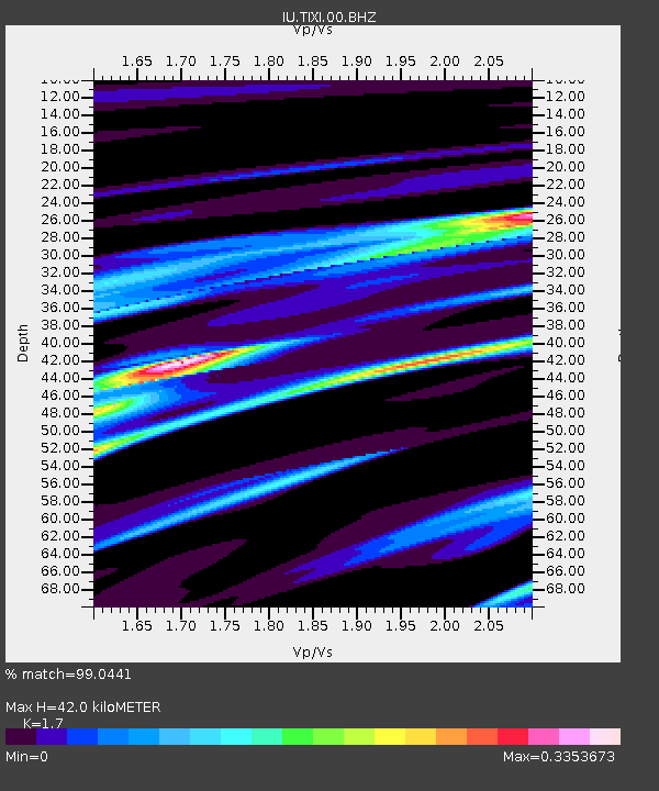
TIXI Tiksi, Russia - Earthquake Result Viewer
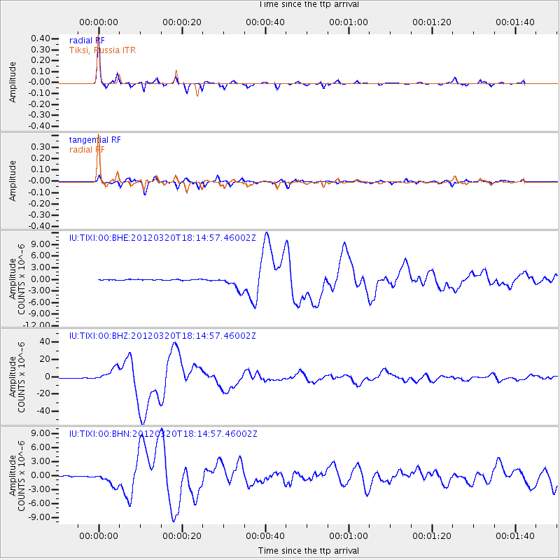
Earthquake location: Near Coast Of Guerrero, Mexico
Earthquake latitude/longitude: 16.5/-98.2
Earthquake time(UTC): 2012/03/20 (080) 18:02:47 GMT
Earthquake Depth: 20 km
Earthquake Magnitude: 6.6 MB, 7.6 MS, 7.4 MW, 7.4 MW
Earthquake Catalog/Contributor: WHDF/NEIC
Network: IU Global Seismograph Network (GSN - IRIS/USGS)
Station: TIXI Tiksi, Russia
Lat/Lon: 71.63 N/128.87 E
Elevation: 40 m
Distance: 86.5 deg
Az: 346.548 deg
Baz: 44.753 deg
Ray Param: 0.043970212
Estimated Moho Depth: 42.0 km
Estimated Crust Vp/Vs: 1.70
Assumed Crust Vp: 6.552 km/s
Estimated Crust Vs: 3.854 km/s
Estimated Crust Poisson's Ratio: 0.24
Radial Match: 99.0441 %
Radial Bump: 215
Transverse Match: 95.40385 %
Transverse Bump: 400
SOD ConfigId: 440406
Insert Time: 2012-06-03 02:30:59.792 +0000
GWidth: 2.5
Max Bumps: 400
Tol: 0.001

Signal To Noise

ChannelStoNSTALTA
IU:TIXI:00:BHZ:20120320T18:14:57.46002Z84.199388.278491E-69.8320086E-8
IU:TIXI:00:BHN:20120320T18:14:57.46002Z18.8213121.5344126E-68.152527E-8
IU:TIXI:00:BHE:20120320T18:14:57.46002Z21.0745721.9869265E-69.428076E-8
Arrivals
Ps4.6 SECOND
PpPs17 SECOND
PsPs/PpSs21 SECOND