You are here: Home > Network List > G - GEOSCOPE Stations List
> Station INU Inuyama, Japan > Earthquake Result Viewer
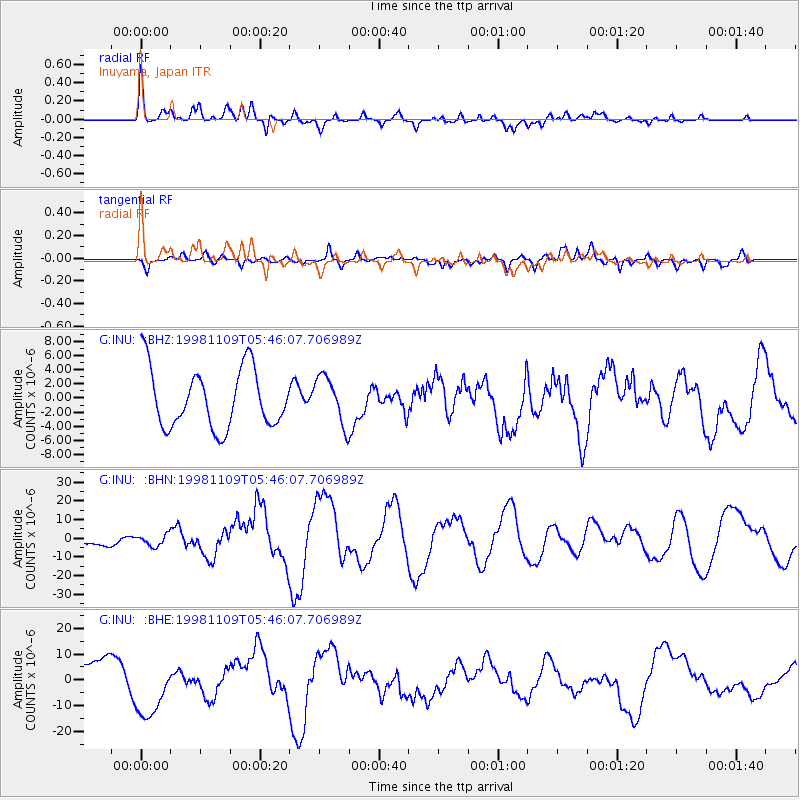
INU Inuyama, Japan - Earthquake Result Viewer
*The percent match for this event was below the threshold and hence no stack was calculated.
| Earthquake location: |
Banda Sea |
| Earthquake latitude/longitude: |
-6.9/128.9 |
| Earthquake time(UTC): |
1998/11/09 (313) 05:38:44 GMT |
| Earthquake Depth: |
33 km |
| Earthquake Magnitude: |
6.4 MB, 7.0 MS, 7.3 UNKNOWN, 7.0 MW |
| Earthquake Catalog/Contributor: |
WHDF/NEIC |
|
| Network: |
G GEOSCOPE |
| Station: |
INU Inuyama, Japan |
| Lat/Lon: |
35.35 N/137.03 E |
| Elevation: |
132 m |
|
| Distance: |
42.7 deg |
| Az: |
9.753 deg |
| Baz: |
191.873 deg |
| Ray Param: |
$rayparam |
*The percent match for this event was below the threshold and hence was not used in the summary stack. |
|
| Radial Match: |
43.274677 % |
| Radial Bump: |
400 |
| Transverse Match: |
59.03832 % |
| Transverse Bump: |
400 |
| SOD ConfigId: |
4480 |
| Insert Time: |
2010-02-26 23:22:58.656 +0000 |
| GWidth: |
2.5 |
| Max Bumps: |
400 |
| Tol: |
0.001 |
|
Signal To Noise
| Channel | StoN | STA | LTA |
| G:INU: :BHN:19981109T05:46:07.706989Z | 1.3789692 | 3.1125794E-6 | 2.2571783E-6 |
| G:INU: :BHE:19981109T05:46:07.706989Z | 1.8266251 | 1.1790217E-5 | 6.4546452E-6 |
| G:INU: :BHZ:19981109T05:46:07.706989Z | 0.8077341 | 3.3524402E-6 | 4.1504254E-6 |
| Arrivals |
| Ps | |
| PpPs | |
| PsPs/PpSs | |


