You are here: Home > Network List > G - GEOSCOPE Stations List
> Station INU Inuyama, Japan > Earthquake Result Viewer
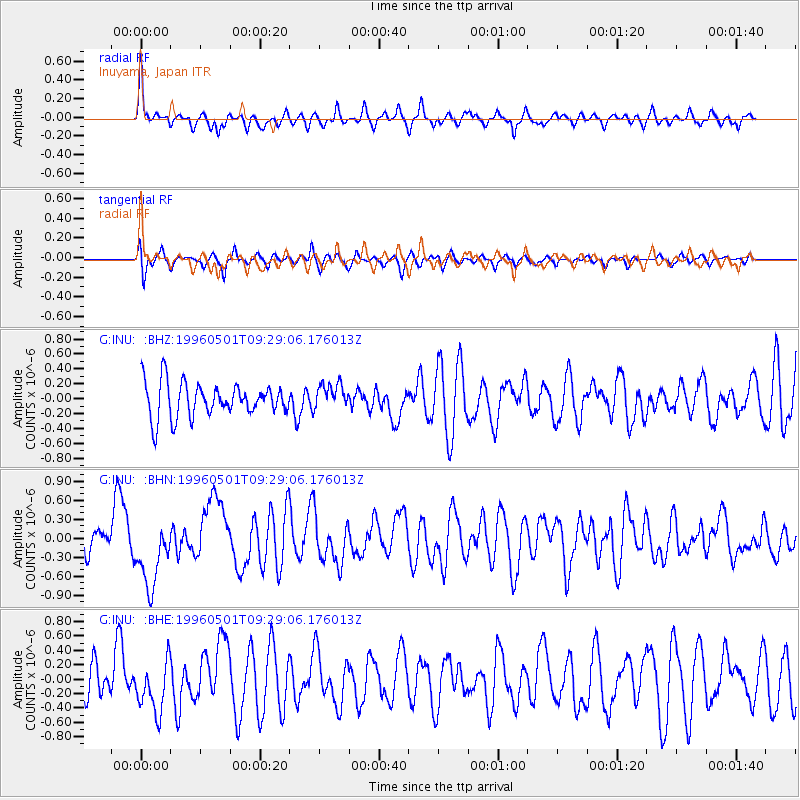
INU Inuyama, Japan - Earthquake Result Viewer
*The percent match for this event was below the threshold and hence no stack was calculated.
| Earthquake location: |
Solomon Islands |
| Earthquake latitude/longitude: |
-6.7/154.8 |
| Earthquake time(UTC): |
1996/05/01 (122) 09:21:24 GMT |
| Earthquake Depth: |
33 km |
| Earthquake Magnitude: |
5.5 MB, 5.9 MS, 6.0 UNKNOWN, 5.9 MW |
| Earthquake Catalog/Contributor: |
WHDF/NEIC |
|
| Network: |
G GEOSCOPE |
| Station: |
INU Inuyama, Japan |
| Lat/Lon: |
35.35 N/137.03 E |
| Elevation: |
132 m |
|
| Distance: |
45.0 deg |
| Az: |
339.294 deg |
| Baz: |
154.555 deg |
| Ray Param: |
$rayparam |
*The percent match for this event was below the threshold and hence was not used in the summary stack. |
|
| Radial Match: |
62.769196 % |
| Radial Bump: |
400 |
| Transverse Match: |
60.009117 % |
| Transverse Bump: |
400 |
| SOD ConfigId: |
4480 |
| Insert Time: |
2010-02-26 23:23:02.490 +0000 |
| GWidth: |
2.5 |
| Max Bumps: |
400 |
| Tol: |
0.001 |
|
Signal To Noise
| Channel | StoN | STA | LTA |
| G:INU: :BHN:19960501T09:29:06.176013Z | 2.2295961 | 5.3755167E-7 | 2.4109823E-7 |
| G:INU: :BHE:19960501T09:29:06.176013Z | 1.685562 | 3.524417E-7 | 2.0909448E-7 |
| G:INU: :BHZ:19960501T09:29:06.176013Z | 0.75199085 | 1.7265758E-7 | 2.2960063E-7 |
| Arrivals |
| Ps | |
| PpPs | |
| PsPs/PpSs | |


