You are here: Home > Network List > G - GEOSCOPE Stations List
> Station INU Inuyama, Japan > Earthquake Result Viewer
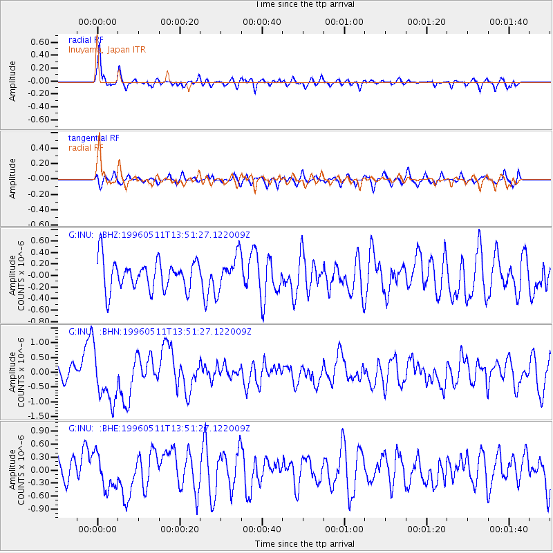
INU Inuyama, Japan - Earthquake Result Viewer
*The percent match for this event was below the threshold and hence no stack was calculated.
| Earthquake location: |
Solomon Islands |
| Earthquake latitude/longitude: |
-6.6/155.0 |
| Earthquake time(UTC): |
1996/05/11 (132) 13:43:45 GMT |
| Earthquake Depth: |
33 km |
| Earthquake Magnitude: |
5.7 MB, 6.3 MS, 6.4 UNKNOWN, 6.3 MW |
| Earthquake Catalog/Contributor: |
WHDF/NEIC |
|
| Network: |
G GEOSCOPE |
| Station: |
INU Inuyama, Japan |
| Lat/Lon: |
35.35 N/137.03 E |
| Elevation: |
132 m |
|
| Distance: |
45.0 deg |
| Az: |
339.077 deg |
| Baz: |
154.279 deg |
| Ray Param: |
$rayparam |
*The percent match for this event was below the threshold and hence was not used in the summary stack. |
|
| Radial Match: |
66.79886 % |
| Radial Bump: |
377 |
| Transverse Match: |
55.645786 % |
| Transverse Bump: |
400 |
| SOD ConfigId: |
4480 |
| Insert Time: |
2010-02-26 23:23:08.979 +0000 |
| GWidth: |
2.5 |
| Max Bumps: |
400 |
| Tol: |
0.001 |
|
Signal To Noise
| Channel | StoN | STA | LTA |
| G:INU: :BHN:19960511T13:51:27.122009Z | 3.0441227 | 8.1790716E-7 | 2.6868403E-7 |
| G:INU: :BHE:19960511T13:51:27.122009Z | 1.5311825 | 3.9876937E-7 | 2.6043227E-7 |
| G:INU: :BHZ:19960511T13:51:27.122009Z | 1.1407536 | 2.9307276E-7 | 2.5691153E-7 |
| Arrivals |
| Ps | |
| PpPs | |
| PsPs/PpSs | |


