
G03D McMinnville, OR, USA - Earthquake Result Viewer
| ||||||||||||||||||
| ||||||||||||||||||
| ||||||||||||||||||
|
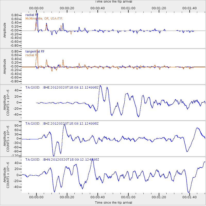
Signal To Noise
| Channel | StoN | STA | LTA |
| TA:G03D: :BHZ:20120320T18:09:12.124998Z | 8.947816 | 1.0899426E-5 | 1.2181104E-6 |
| TA:G03D: :BHN:20120320T18:09:12.124998Z | 2.7204905 | 5.1848206E-6 | 1.9058403E-6 |
| TA:G03D: :BHE:20120320T18:09:12.124998Z | 3.7849061 | 4.5308775E-6 | 1.1970911E-6 |
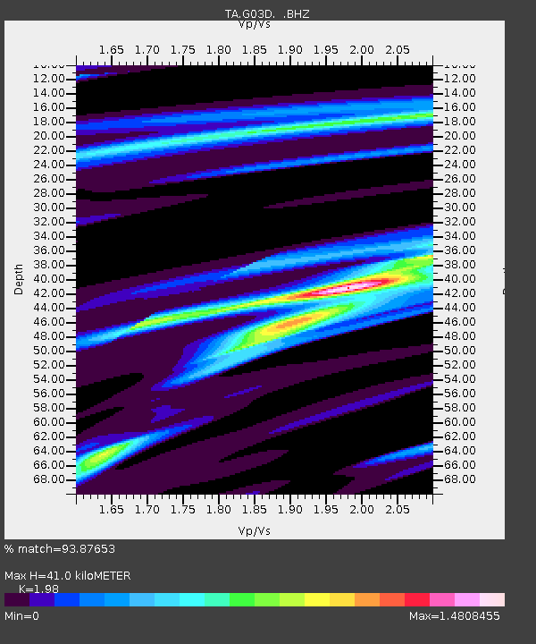
| Arrivals | |
| Ps | 6.6 SECOND |
| PpPs | 17 SECOND |
| PsPs/PpSs | 24 SECOND |

