N02D Trinity Center, CA, USA - Earthquake Result Viewer
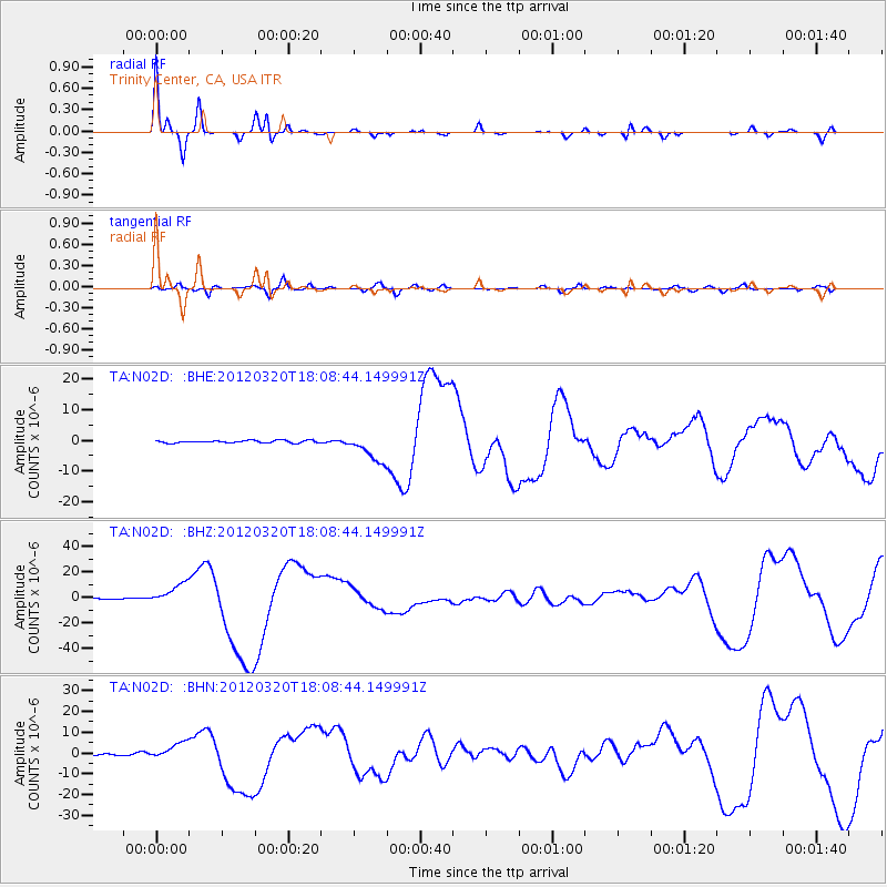
Earthquake location: Near Coast Of Guerrero, Mexico
Earthquake latitude/longitude: 16.5/-98.2
Earthquake time(UTC): 2012/03/20 (080) 18:02:47 GMT
Earthquake Depth: 20 km
Earthquake Magnitude: 6.6 MB, 7.6 MS, 7.4 MW, 7.4 MW
Earthquake Catalog/Contributor: WHDF/NEIC
Network: TA USArray Transportable Network (new EarthScope stations)
Station: N02D Trinity Center, CA, USA
Lat/Lon: 40.97 N/122.71 W
Elevation: 937 m
Distance: 32.3 deg
Az: 324.03 deg
Baz: 131.909 deg
Ray Param: 0.07869929
Estimated Moho Depth: 48.0 km
Estimated Crust Vp/Vs: 1.82
Assumed Crust Vp: 6.566 km/s
Estimated Crust Vs: 3.608 km/s
Estimated Crust Poisson's Ratio: 0.28
Radial Match: 90.53317 %
Radial Bump: 250
Transverse Match: 63.82413 %
Transverse Bump: 400
SOD ConfigId: 440406
Insert Time: 2012-06-03 02:35:28.754 +0000
GWidth: 2.5
Max Bumps: 400
Tol: 0.001

Signal To Noise

ChannelStoNSTALTA
TA:N02D: :BHZ:20120320T18:08:44.149991Z24.176098.289332E-63.4287314E-7
TA:N02D: :BHN:20120320T18:08:44.149991Z10.4813363.9957413E-63.8122442E-7
TA:N02D: :BHE:20120320T18:08:44.149991Z11.4429884.618458E-64.0360595E-7
Arrivals
Ps6.5 SECOND
PpPs19 SECOND
PsPs/PpSs26 SECOND