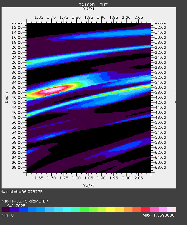
L02D Cave Junction, OR, USA - Earthquake Result Viewer
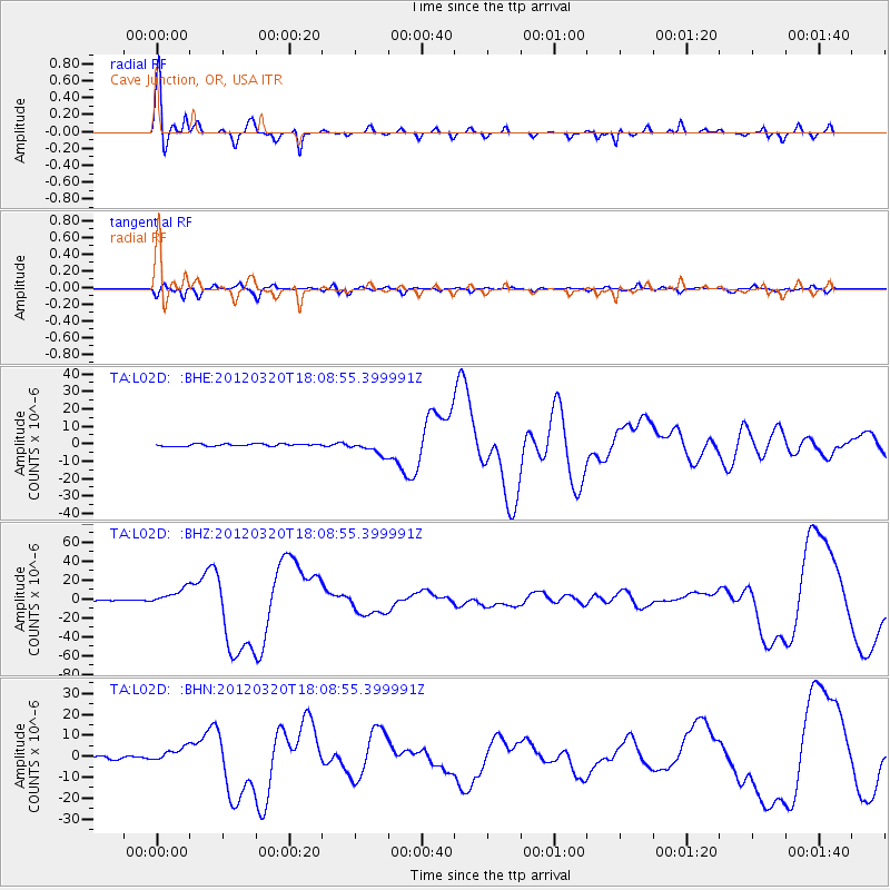
Earthquake location: Near Coast Of Guerrero, Mexico
Earthquake latitude/longitude: 16.5/-98.2
Earthquake time(UTC): 2012/03/20 (080) 18:02:47 GMT
Earthquake Depth: 20 km
Earthquake Magnitude: 6.6 MB, 7.6 MS, 7.4 MW, 7.4 MW
Earthquake Catalog/Contributor: WHDF/NEIC
Network: TA USArray Transportable Network (new EarthScope stations)
Station: L02D Cave Junction, OR, USA
Lat/Lon: 42.16 N/123.60 W
Elevation: 458 m
Distance: 33.6 deg
Az: 324.819 deg
Baz: 131.978 deg
Ray Param: 0.07812484
Estimated Moho Depth: 36.75 km
Estimated Crust Vp/Vs: 1.70
Assumed Crust Vp: 6.522 km/s
Estimated Crust Vs: 3.831 km/s
Estimated Crust Poisson's Ratio: 0.24
Radial Match: 86.075775 %
Radial Bump: 324
Transverse Match: 79.79631 %
Transverse Bump: 400
SOD ConfigId: 440406
Insert Time: 2012-06-03 02:35:34.543 +0000
GWidth: 2.5
Max Bumps: 400
Tol: 0.001

Signal To Noise

ChannelStoNSTALTA
TA:L02D: :BHZ:20120320T18:08:55.399991Z9.5721148.30266E-68.673799E-7
TA:L02D: :BHN:20120320T18:08:55.399991Z4.95812033.417373E-66.892476E-7
TA:L02D: :BHE:20120320T18:08:55.399991Z6.007463.923318E-66.530744E-7
Arrivals
Ps4.3 SECOND
PpPs14 SECOND
PsPs/PpSs18 SECOND