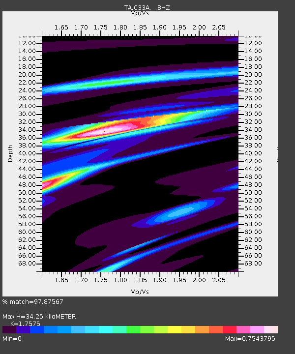
C33A Trail, MN, USA - Earthquake Result Viewer
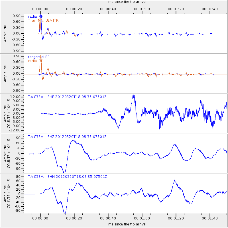
Earthquake location: Near Coast Of Guerrero, Mexico
Earthquake latitude/longitude: 16.5/-98.2
Earthquake time(UTC): 2012/03/20 (080) 18:02:47 GMT
Earthquake Depth: 20 km
Earthquake Magnitude: 6.6 MB, 7.6 MS, 7.4 MW, 7.4 MW
Earthquake Catalog/Contributor: WHDF/NEIC
Network: TA USArray Transportable Network (new EarthScope stations)
Station: C33A Trail, MN, USA
Lat/Lon: 47.76 N/95.77 W
Elevation: 388 m
Distance: 31.2 deg
Az: 3.199 deg
Baz: 184.551 deg
Ray Param: 0.07910796
Estimated Moho Depth: 34.25 km
Estimated Crust Vp/Vs: 1.76
Assumed Crust Vp: 6.419 km/s
Estimated Crust Vs: 3.652 km/s
Estimated Crust Poisson's Ratio: 0.26
Radial Match: 97.87567 %
Radial Bump: 284
Transverse Match: 82.03962 %
Transverse Bump: 400
SOD ConfigId: 440406
Insert Time: 2012-06-03 02:38:24.440 +0000
GWidth: 2.5
Max Bumps: 400
Tol: 0.001

Signal To Noise

ChannelStoNSTALTA
TA:C33A: :BHZ:20120320T18:08:35.07501Z42.350691.9874657E-54.6928764E-7
TA:C33A: :BHN:20120320T18:08:35.07501Z49.9244271.4437164E-52.8918038E-7
TA:C33A: :BHE:20120320T18:08:35.07501Z3.4307138.9751353E-72.6161138E-7
Arrivals
Ps4.4 SECOND
PpPs14 SECOND
PsPs/PpSs18 SECOND