TOLK Tollok Lake Research Station, AK, USA - Earthquake Result Viewer
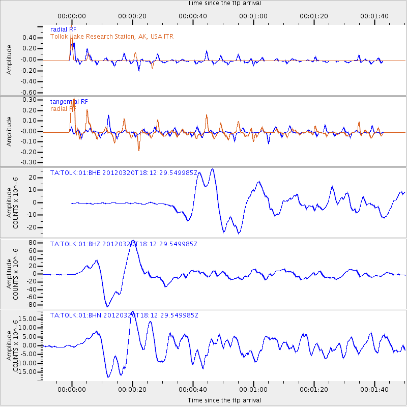
Earthquake location: Near Coast Of Guerrero, Mexico
Earthquake latitude/longitude: 16.5/-98.2
Earthquake time(UTC): 2012/03/20 (080) 18:02:47 GMT
Earthquake Depth: 20 km
Earthquake Magnitude: 6.6 MB, 7.6 MS, 7.4 MW, 7.4 MW
Earthquake Catalog/Contributor: WHDF/NEIC
Network: TA USArray Transportable Network (new EarthScope stations)
Station: TOLK Tollok Lake Research Station, AK, USA
Lat/Lon: 68.64 N/149.57 W
Elevation: 760 m
Distance: 61.2 deg
Az: 340.943 deg
Baz: 121.232 deg
Ray Param: 0.061020162
Estimated Moho Depth: 41.5 km
Estimated Crust Vp/Vs: 1.74
Assumed Crust Vp: 6.316 km/s
Estimated Crust Vs: 3.63 km/s
Estimated Crust Poisson's Ratio: 0.25
Radial Match: 97.493126 %
Radial Bump: 400
Transverse Match: 91.69615 %
Transverse Bump: 400
SOD ConfigId: 440406
Insert Time: 2012-06-03 02:40:13.911 +0000
GWidth: 2.5
Max Bumps: 400
Tol: 0.001

Signal To Noise

ChannelStoNSTALTA
TA:TOLK:01:BHZ:20120320T18:12:29.549985Z16.9663339.273927E-65.466076E-7
TA:TOLK:01:BHN:20120320T18:12:29.549985Z6.39005661.7583619E-62.7517157E-7
TA:TOLK:01:BHE:20120320T18:12:29.549985Z8.6474112.5993586E-63.0059383E-7
Arrivals
Ps5.1 SECOND
PpPs17 SECOND
PsPs/PpSs22 SECOND