F41A Wisconsin Rapids, WI, USA - Earthquake Result Viewer
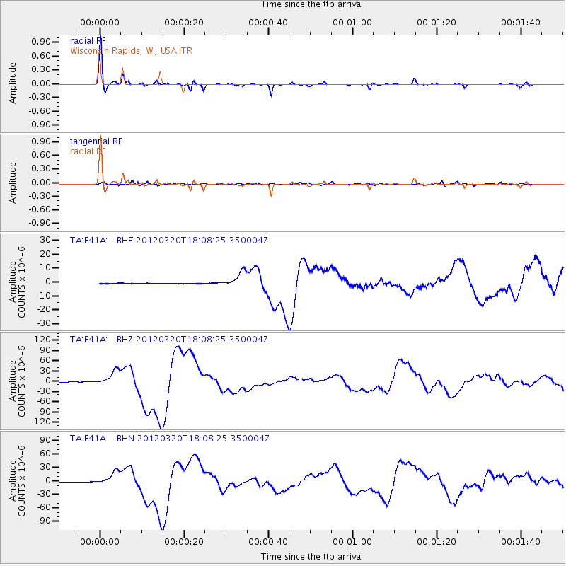
Earthquake location: Near Coast Of Guerrero, Mexico
Earthquake latitude/longitude: 16.5/-98.2
Earthquake time(UTC): 2012/03/20 (080) 18:02:47 GMT
Earthquake Depth: 20 km
Earthquake Magnitude: 6.6 MB, 7.6 MS, 7.4 MW, 7.4 MW
Earthquake Catalog/Contributor: WHDF/NEIC
Network: TA USArray Transportable Network (new EarthScope stations)
Station: F41A Wisconsin Rapids, WI, USA
Lat/Lon: 45.74 N/89.10 W
Elevation: 509 m
Distance: 30.1 deg
Az: 12.78 deg
Baz: 197.64 deg
Ray Param: 0.079397276
Estimated Moho Depth: 38.25 km
Estimated Crust Vp/Vs: 1.89
Assumed Crust Vp: 6.41 km/s
Estimated Crust Vs: 3.396 km/s
Estimated Crust Poisson's Ratio: 0.30
Radial Match: 97.29178 %
Radial Bump: 228
Transverse Match: 81.73344 %
Transverse Bump: 400
SOD ConfigId: 440406
Insert Time: 2012-06-03 02:40:38.627 +0000
GWidth: 2.5
Max Bumps: 400
Tol: 0.001

Signal To Noise

ChannelStoNSTALTA
TA:F41A: :BHZ:20120320T18:08:25.350004Z90.122822.340033E-52.5964934E-7
TA:F41A: :BHN:20120320T18:08:25.350004Z57.5118561.5876105E-52.7604924E-7
TA:F41A: :BHE:20120320T18:08:25.350004Z40.0675625.7934617E-61.445923E-7
Arrivals
Ps5.7 SECOND
PpPs16 SECOND
PsPs/PpSs22 SECOND