
D41A Chassel, MI, USA - Earthquake Result Viewer
| ||||||||||||||||||
| ||||||||||||||||||
| ||||||||||||||||||
|
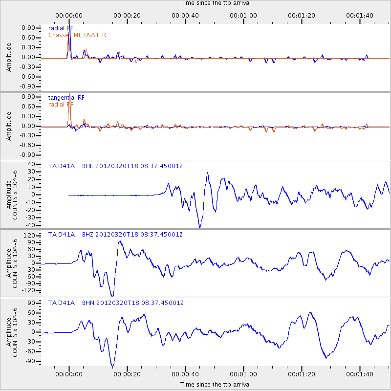
Signal To Noise
| Channel | StoN | STA | LTA |
| TA:D41A: :BHZ:20120320T18:08:37.45001Z | 53.03549 | 2.6222791E-5 | 4.9443855E-7 |
| TA:D41A: :BHN:20120320T18:08:37.45001Z | 36.561203 | 1.6877377E-5 | 4.6161986E-7 |
| TA:D41A: :BHE:20120320T18:08:37.45001Z | 30.038713 | 6.450658E-6 | 2.1474482E-7 |
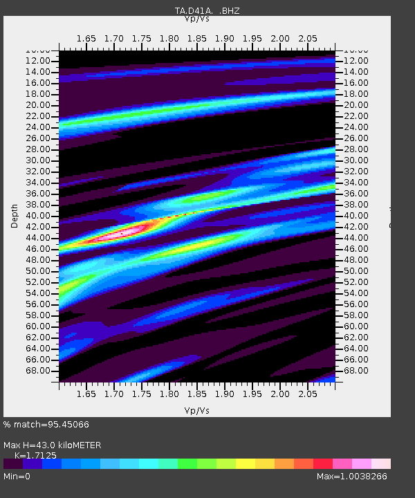
| Arrivals | |
| Ps | 5.2 SECOND |
| PpPs | 17 SECOND |
| PsPs/PpSs | 22 SECOND |

