
E42A Champion, MI, USA - Earthquake Result Viewer
| ||||||||||||||||||
| ||||||||||||||||||
| ||||||||||||||||||
|
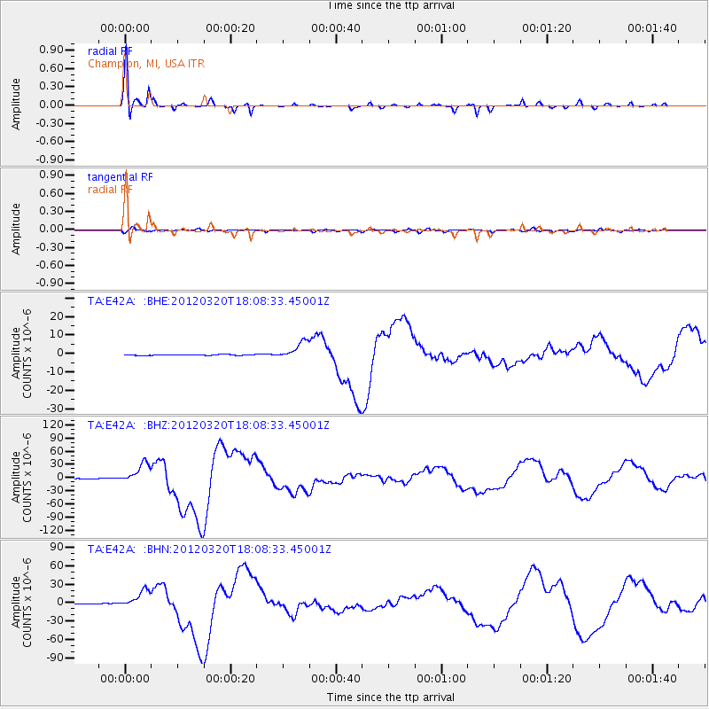
Signal To Noise
| Channel | StoN | STA | LTA |
| TA:E42A: :BHZ:20120320T18:08:33.45001Z | 93.67895 | 2.3216671E-5 | 2.4783233E-7 |
| TA:E42A: :BHN:20120320T18:08:33.45001Z | 66.493416 | 1.4500733E-5 | 2.1807773E-7 |
| TA:E42A: :BHE:20120320T18:08:33.45001Z | 21.639126 | 4.8154575E-6 | 2.2253475E-7 |
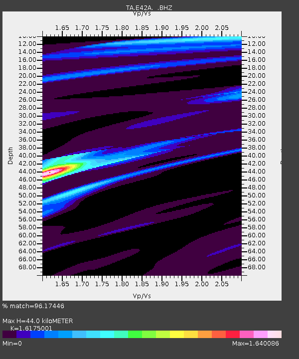
| Arrivals | |
| Ps | 4.6 SECOND |
| PpPs | 16 SECOND |
| PsPs/PpSs | 21 SECOND |

