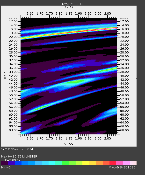
LTY Liberty (broad-band) - Earthquake Result Viewer

Earthquake location: Near Coast Of Guerrero, Mexico
Earthquake latitude/longitude: 16.5/-98.2
Earthquake time(UTC): 2012/03/20 (080) 18:02:47 GMT
Earthquake Depth: 20 km
Earthquake Magnitude: 6.6 MB, 7.6 MS, 7.4 MW, 7.4 MW
Earthquake Catalog/Contributor: WHDF/NEIC
Network: UW Pacific Northwest Regional Seismic Network
Station: LTY Liberty (broad-band)
Lat/Lon: 47.26 N/120.66 W
Elevation: 970 m
Distance: 35.8 deg
Az: 333.646 deg
Baz: 141.302 deg
Ray Param: 0.07697963
Estimated Moho Depth: 15.25 km
Estimated Crust Vp/Vs: 2.10
Assumed Crust Vp: 6.597 km/s
Estimated Crust Vs: 3.145 km/s
Estimated Crust Poisson's Ratio: 0.35
Radial Match: 95.935074 %
Radial Bump: 206
Transverse Match: 94.72931 %
Transverse Bump: 336
SOD ConfigId: 440406
Insert Time: 2012-06-03 02:42:22.552 +0000
GWidth: 2.5
Max Bumps: 400
Tol: 0.001

Signal To Noise

ChannelStoNSTALTA
UW:LTY: :BHZ:20120320T18:09:14.980009Z21.0357151.1735941E-55.5790554E-7
UW:LTY: :BHN:20120320T18:09:14.980009Z18.5923046.5188824E-63.506226E-7
UW:LTY: :BHE:20120320T18:09:14.980009Z2.99781732.092014E-66.978458E-7
Arrivals
Ps2.7 SECOND
PpPs6.7 SECOND
PsPs/PpSs9.4 SECOND