MRBL Marblemount, WA, USA - Earthquake Result Viewer
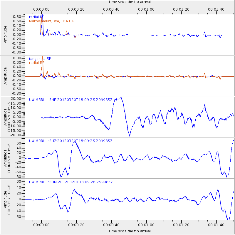
Earthquake location: Near Coast Of Guerrero, Mexico
Earthquake latitude/longitude: 16.5/-98.2
Earthquake time(UTC): 2012/03/20 (080) 18:02:47 GMT
Earthquake Depth: 20 km
Earthquake Magnitude: 6.6 MB, 7.6 MS, 7.4 MW, 7.4 MW
Earthquake Catalog/Contributor: WHDF/NEIC
Network: UW Pacific Northwest Regional Seismic Network
Station: MRBL Marblemount, WA, USA
Lat/Lon: 48.52 N/121.48 W
Elevation: 75 m
Distance: 37.2 deg
Az: 334.252 deg
Baz: 141.183 deg
Ray Param: 0.07625514
Estimated Moho Depth: 25.0 km
Estimated Crust Vp/Vs: 1.78
Assumed Crust Vp: 6.566 km/s
Estimated Crust Vs: 3.689 km/s
Estimated Crust Poisson's Ratio: 0.27
Radial Match: 93.01893 %
Radial Bump: 238
Transverse Match: 59.610207 %
Transverse Bump: 264
SOD ConfigId: 440406
Insert Time: 2012-06-03 02:42:47.001 +0000
GWidth: 2.5
Max Bumps: 400
Tol: 0.001

Signal To Noise

ChannelStoNSTALTA
UW:MRBL: :BHZ:20120320T18:09:26.299985Z10.443261.0516449E-51.0070082E-6
UW:MRBL: :BHN:20120320T18:09:26.299985Z5.83369264.488919E-67.694816E-7
UW:MRBL: :BHE:20120320T18:09:26.299985Z5.76765062.883198E-64.9989126E-7
Arrivals
Ps3.2 SECOND
PpPs9.8 SECOND
PsPs/PpSs13 SECOND