UMAT Pilot Rock, OR, USA - Earthquake Result Viewer
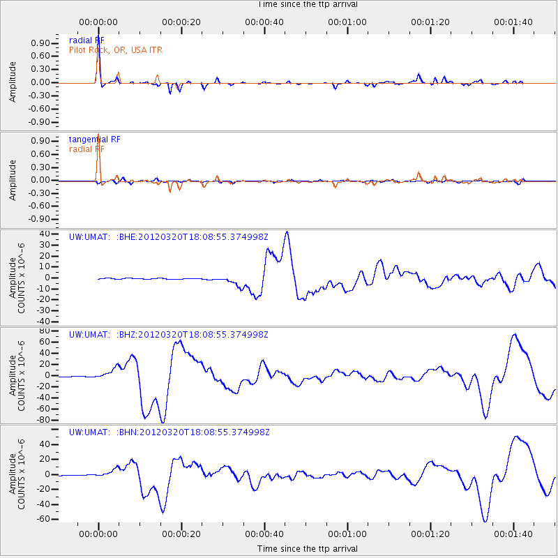
Earthquake location: Near Coast Of Guerrero, Mexico
Earthquake latitude/longitude: 16.5/-98.2
Earthquake time(UTC): 2012/03/20 (080) 18:02:47 GMT
Earthquake Depth: 20 km
Earthquake Magnitude: 6.6 MB, 7.6 MS, 7.4 MW, 7.4 MW
Earthquake Catalog/Contributor: WHDF/NEIC
Network: UW Pacific Northwest Regional Seismic Network
Station: UMAT Pilot Rock, OR, USA
Lat/Lon: 45.29 N/118.96 W
Elevation: 1318 m
Distance: 33.6 deg
Az: 333.137 deg
Baz: 142.113 deg
Ray Param: 0.0781265
Estimated Moho Depth: 31.25 km
Estimated Crust Vp/Vs: 1.91
Assumed Crust Vp: 6.571 km/s
Estimated Crust Vs: 3.445 km/s
Estimated Crust Poisson's Ratio: 0.31
Radial Match: 91.510414 %
Radial Bump: 237
Transverse Match: 70.98496 %
Transverse Bump: 400
SOD ConfigId: 440406
Insert Time: 2012-06-03 02:43:13.658 +0000
GWidth: 2.5
Max Bumps: 400
Tol: 0.001

Signal To Noise

ChannelStoNSTALTA
UW:UMAT: :BHZ:20120320T18:08:55.374998Z31.9822481.0411169E-53.255296E-7
UW:UMAT: :BHN:20120320T18:08:55.374998Z12.8146085.683086E-64.43485E-7
UW:UMAT: :BHE:20120320T18:08:55.374998Z14.6179215.032636E-63.442785E-7
Arrivals
Ps4.7 SECOND
PpPs13 SECOND
PsPs/PpSs17 SECOND