You are here: Home > Network List > G - GEOSCOPE Stations List
> Station INU Inuyama, Japan > Earthquake Result Viewer
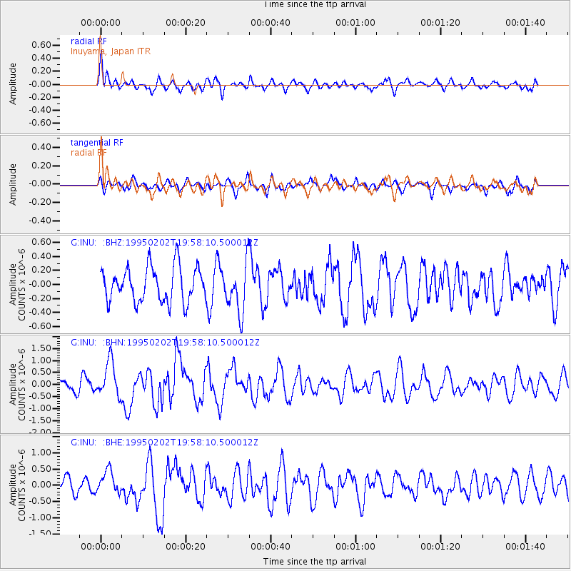
INU Inuyama, Japan - Earthquake Result Viewer
*The percent match for this event was below the threshold and hence no stack was calculated.
| Earthquake location: |
New Britain Region, P.N.G. |
| Earthquake latitude/longitude: |
-6.3/148.9 |
| Earthquake time(UTC): |
1995/02/02 (033) 19:50:48 GMT |
| Earthquake Depth: |
64 km |
| Earthquake Magnitude: |
6.0 UNKNOWN, 5.4 MB, 6.0 MW |
| Earthquake Catalog/Contributor: |
WHDF/NEIC |
|
| Network: |
G GEOSCOPE |
| Station: |
INU Inuyama, Japan |
| Lat/Lon: |
35.35 N/137.03 E |
| Elevation: |
132 m |
|
| Distance: |
42.9 deg |
| Az: |
345.742 deg |
| Baz: |
162.572 deg |
| Ray Param: |
$rayparam |
*The percent match for this event was below the threshold and hence was not used in the summary stack. |
|
| Radial Match: |
62.282673 % |
| Radial Bump: |
400 |
| Transverse Match: |
44.810005 % |
| Transverse Bump: |
400 |
| SOD ConfigId: |
4480 |
| Insert Time: |
2010-02-26 23:23:26.767 +0000 |
| GWidth: |
2.5 |
| Max Bumps: |
400 |
| Tol: |
0.001 |
|
Signal To Noise
| Channel | StoN | STA | LTA |
| G:INU: :BHN:19950202T19:58:10.500012Z | 2.5270224 | 7.6003437E-7 | 3.0076282E-7 |
| G:INU: :BHE:19950202T19:58:10.500012Z | 1.3042793 | 3.6266817E-7 | 2.780602E-7 |
| G:INU: :BHZ:19950202T19:58:10.500012Z | 1.435934 | 3.5592115E-7 | 2.4786735E-7 |
| Arrivals |
| Ps | |
| PpPs | |
| PsPs/PpSs | |


