You are here: Home > Network List > G - GEOSCOPE Stations List
> Station INU Inuyama, Japan > Earthquake Result Viewer
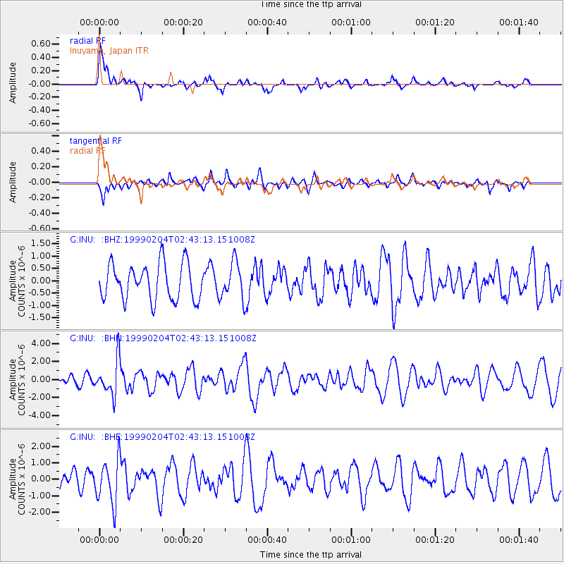
INU Inuyama, Japan - Earthquake Result Viewer
*The percent match for this event was below the threshold and hence no stack was calculated.
| Earthquake location: |
Eastern New Guinea Reg., P.N.G. |
| Earthquake latitude/longitude: |
-8.6/149.3 |
| Earthquake time(UTC): |
1999/02/04 (035) 02:35:36 GMT |
| Earthquake Depth: |
98 km |
| Earthquake Magnitude: |
5.7 MB, 5.9 MW, 5.8 MW |
| Earthquake Catalog/Contributor: |
WHDF/NEIC |
|
| Network: |
G GEOSCOPE |
| Station: |
INU Inuyama, Japan |
| Lat/Lon: |
35.35 N/137.03 E |
| Elevation: |
132 m |
|
| Distance: |
45.2 deg |
| Az: |
345.859 deg |
| Baz: |
162.81 deg |
| Ray Param: |
$rayparam |
*The percent match for this event was below the threshold and hence was not used in the summary stack. |
|
| Radial Match: |
79.1758 % |
| Radial Bump: |
400 |
| Transverse Match: |
45.957005 % |
| Transverse Bump: |
396 |
| SOD ConfigId: |
4480 |
| Insert Time: |
2010-02-26 23:23:44.483 +0000 |
| GWidth: |
2.5 |
| Max Bumps: |
400 |
| Tol: |
0.001 |
|
Signal To Noise
| Channel | StoN | STA | LTA |
| G:INU: :BHN:19990204T02:43:13.151008Z | 2.9042475 | 2.0209995E-6 | 6.958772E-7 |
| G:INU: :BHE:19990204T02:43:13.151008Z | 2.3682323 | 1.3885049E-6 | 5.863044E-7 |
| G:INU: :BHZ:19990204T02:43:13.151008Z | 1.052289 | 7.654542E-7 | 7.2741824E-7 |
| Arrivals |
| Ps | |
| PpPs | |
| PsPs/PpSs | |


