You are here: Home > Network List > G - GEOSCOPE Stations List
> Station INU Inuyama, Japan > Earthquake Result Viewer
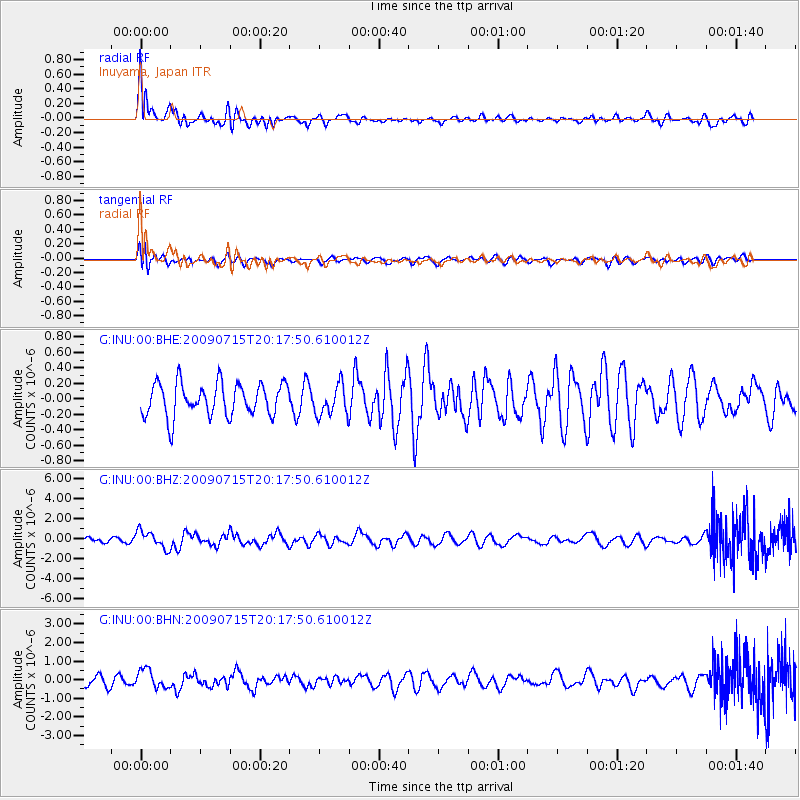
INU Inuyama, Japan - Earthquake Result Viewer
*The percent match for this event was below the threshold and hence no stack was calculated.
| Earthquake location: |
New Ireland Region, P.N.G. |
| Earthquake latitude/longitude: |
-3.4/150.5 |
| Earthquake time(UTC): |
2009/07/15 (196) 20:10:42 GMT |
| Earthquake Depth: |
13 km |
| Earthquake Magnitude: |
5.6 MB, 6.1 MS, 6.1 MW, 6.1 MW |
| Earthquake Catalog/Contributor: |
WHDF/NEIC |
|
| Network: |
G GEOSCOPE |
| Station: |
INU Inuyama, Japan |
| Lat/Lon: |
35.35 N/137.03 E |
| Elevation: |
132 m |
|
| Distance: |
40.5 deg |
| Az: |
342.957 deg |
| Baz: |
159.028 deg |
| Ray Param: |
$rayparam |
*The percent match for this event was below the threshold and hence was not used in the summary stack. |
|
| Radial Match: |
63.672157 % |
| Radial Bump: |
400 |
| Transverse Match: |
51.590565 % |
| Transverse Bump: |
400 |
| SOD ConfigId: |
2648 |
| Insert Time: |
2010-02-26 23:23:48.859 +0000 |
| GWidth: |
2.5 |
| Max Bumps: |
400 |
| Tol: |
0.001 |
|
Signal To Noise
| Channel | StoN | STA | LTA |
| G:INU:00:BHZ:20090715T20:17:50.610012Z | 2.7039614 | 8.55569E-7 | 3.1641318E-7 |
| G:INU:00:BHN:20090715T20:17:50.610012Z | 1.2942548 | 4.978581E-7 | 3.8466771E-7 |
| G:INU:00:BHE:20090715T20:17:50.610012Z | 0.9287359 | 1.9772058E-7 | 2.1289213E-7 |
| Arrivals |
| Ps | |
| PpPs | |
| PsPs/PpSs | |


