You are here: Home > Network List > G - GEOSCOPE Stations List
> Station INU Inuyama, Japan > Earthquake Result Viewer
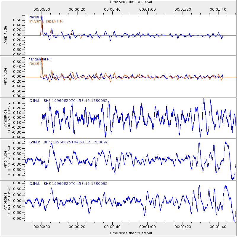
INU Inuyama, Japan - Earthquake Result Viewer
*The percent match for this event was below the threshold and hence no stack was calculated.
| Earthquake location: |
Near North Coast Of Irian Jaya |
| Earthquake latitude/longitude: |
-2.8/139.1 |
| Earthquake time(UTC): |
1996/06/29 (181) 04:46:28 GMT |
| Earthquake Depth: |
33 km |
| Earthquake Magnitude: |
5.9 MS, 5.4 MB, 5.9 UNKNOWN, 5.8 MW |
| Earthquake Catalog/Contributor: |
WHDF/NEIC |
|
| Network: |
G GEOSCOPE |
| Station: |
INU Inuyama, Japan |
| Lat/Lon: |
35.35 N/137.03 E |
| Elevation: |
132 m |
|
| Distance: |
38.0 deg |
| Az: |
357.213 deg |
| Baz: |
176.594 deg |
| Ray Param: |
$rayparam |
*The percent match for this event was below the threshold and hence was not used in the summary stack. |
|
| Radial Match: |
75.73272 % |
| Radial Bump: |
379 |
| Transverse Match: |
48.91936 % |
| Transverse Bump: |
400 |
| SOD ConfigId: |
4480 |
| Insert Time: |
2010-02-26 23:23:53.636 +0000 |
| GWidth: |
2.5 |
| Max Bumps: |
400 |
| Tol: |
0.001 |
|
Signal To Noise
| Channel | StoN | STA | LTA |
| G:INU: :BHN:19960629T04:53:12.178009Z | 2.9236472 | 2.914694E-7 | 9.969377E-8 |
| G:INU: :BHE:19960629T04:53:12.178009Z | 1.5301563 | 2.1064493E-7 | 1.3766235E-7 |
| G:INU: :BHZ:19960629T04:53:12.178009Z | 0.7704771 | 1.0342486E-7 | 1.3423482E-7 |
| Arrivals |
| Ps | |
| PpPs | |
| PsPs/PpSs | |


