You are here: Home > Network List > US - United States National Seismic Network Stations List
> Station BOZ Bozeman, Montana, USA > Earthquake Result Viewer
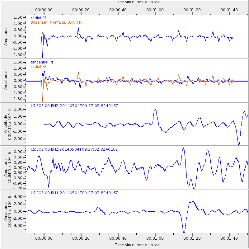
BOZ Bozeman, Montana, USA - Earthquake Result Viewer
*The percent match for this event was below the threshold and hence no stack was calculated.
| Earthquake location: |
South Of Fiji Islands |
| Earthquake latitude/longitude: |
-25.8/178.2 |
| Earthquake time(UTC): |
2014/05/04 (124) 09:25:14 GMT |
| Earthquake Depth: |
611 km |
| Earthquake Magnitude: |
6.1 MB |
| Earthquake Catalog/Contributor: |
NEIC PDE/NEIC COMCAT |
|
| Network: |
US United States National Seismic Network |
| Station: |
BOZ Bozeman, Montana, USA |
| Lat/Lon: |
45.65 N/111.63 W |
| Elevation: |
1589 m |
|
| Distance: |
95.4 deg |
| Az: |
41.512 deg |
| Baz: |
238.402 deg |
| Ray Param: |
$rayparam |
*The percent match for this event was below the threshold and hence was not used in the summary stack. |
|
| Radial Match: |
58.632996 % |
| Radial Bump: |
295 |
| Transverse Match: |
66.11053 % |
| Transverse Bump: |
363 |
| SOD ConfigId: |
3390531 |
| Insert Time: |
2019-04-11 17:01:36.589 +0000 |
| GWidth: |
2.5 |
| Max Bumps: |
400 |
| Tol: |
0.001 |
|
Signal To Noise
| Channel | StoN | STA | LTA |
| US:BOZ:00:BHZ:20140504T09:37:02.824016Z | 2.6376374 | 4.9171416E-7 | 1.8642218E-7 |
| US:BOZ:00:BH1:20140504T09:37:02.824016Z | 0.6600258 | 1.3393039E-7 | 2.0291691E-7 |
| US:BOZ:00:BH2:20140504T09:37:02.824016Z | 1.1427257 | 2.3378973E-7 | 2.0458954E-7 |
| Arrivals |
| Ps | |
| PpPs | |
| PsPs/PpSs | |


