You are here: Home > Network List > G - GEOSCOPE Stations List
> Station TAM Tamanrasset, Algeria > Earthquake Result Viewer
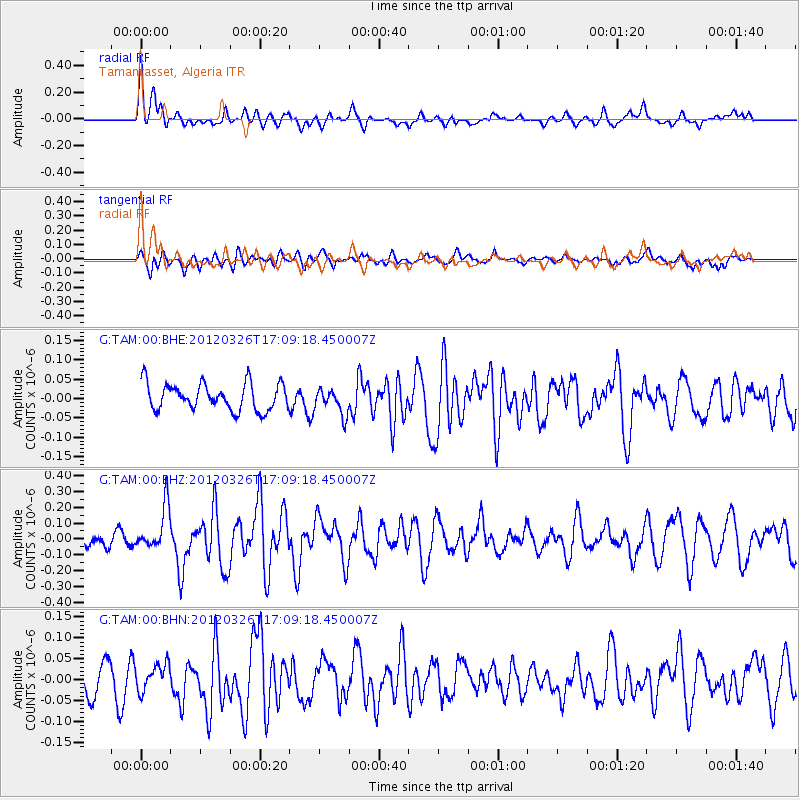
TAM Tamanrasset, Algeria - Earthquake Result Viewer
*The percent match for this event was below the threshold and hence no stack was calculated.
| Earthquake location: |
Southwest Indian Ridge |
| Earthquake latitude/longitude: |
-30.0/60.7 |
| Earthquake time(UTC): |
2012/03/26 (086) 16:58:10 GMT |
| Earthquake Depth: |
10 km |
| Earthquake Magnitude: |
5.7 MB, 5.3 MS, 5.6 MW, 5.6 MW |
| Earthquake Catalog/Contributor: |
WHDF/NEIC |
|
| Network: |
G GEOSCOPE |
| Station: |
TAM Tamanrasset, Algeria |
| Lat/Lon: |
22.79 N/5.53 E |
| Elevation: |
1377 m |
|
| Distance: |
74.6 deg |
| Az: |
308.247 deg |
| Baz: |
132.445 deg |
| Ray Param: |
$rayparam |
*The percent match for this event was below the threshold and hence was not used in the summary stack. |
|
| Radial Match: |
64.156654 % |
| Radial Bump: |
400 |
| Transverse Match: |
59.789394 % |
| Transverse Bump: |
400 |
| SOD ConfigId: |
440406 |
| Insert Time: |
2012-06-08 06:20:34.932 +0000 |
| GWidth: |
2.5 |
| Max Bumps: |
400 |
| Tol: |
0.001 |
|
Signal To Noise
| Channel | StoN | STA | LTA |
| G:TAM:00:BHZ:20120326T17:09:18.450007Z | 2.0619075 | 1.3481393E-7 | 6.5383105E-8 |
| G:TAM:00:BHN:20120326T17:09:18.450007Z | 0.74747837 | 3.1221024E-8 | 4.1768466E-8 |
| G:TAM:00:BHE:20120326T17:09:18.450007Z | 0.9867774 | 3.401633E-8 | 3.447214E-8 |
| Arrivals |
| Ps | |
| PpPs | |
| PsPs/PpSs | |


