You are here: Home > Network List > G - GEOSCOPE Stations List
> Station INU Inuyama, Japan > Earthquake Result Viewer
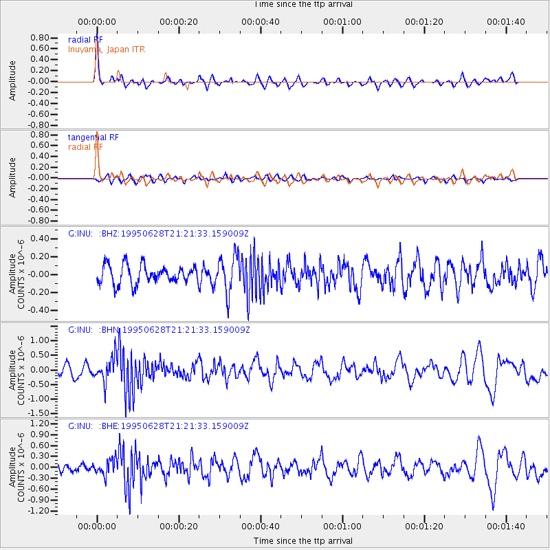
INU Inuyama, Japan - Earthquake Result Viewer
*The percent match for this event was below the threshold and hence no stack was calculated.
| Earthquake location: |
Halmahera, Indonesia |
| Earthquake latitude/longitude: |
-1.6/127.4 |
| Earthquake time(UTC): |
1995/06/28 (179) 21:14:49 GMT |
| Earthquake Depth: |
33 km |
| Earthquake Magnitude: |
5.6 MB, 5.4 MS, 5.9 UNKNOWN |
| Earthquake Catalog/Contributor: |
WHDF/NEIC |
|
| Network: |
G GEOSCOPE |
| Station: |
INU Inuyama, Japan |
| Lat/Lon: |
35.35 N/137.03 E |
| Elevation: |
132 m |
|
| Distance: |
37.9 deg |
| Az: |
12.917 deg |
| Baz: |
195.864 deg |
| Ray Param: |
$rayparam |
*The percent match for this event was below the threshold and hence was not used in the summary stack. |
|
| Radial Match: |
77.14324 % |
| Radial Bump: |
400 |
| Transverse Match: |
57.511814 % |
| Transverse Bump: |
400 |
| SOD ConfigId: |
4480 |
| Insert Time: |
2010-02-26 23:24:32.070 +0000 |
| GWidth: |
2.5 |
| Max Bumps: |
400 |
| Tol: |
0.001 |
|
Signal To Noise
| Channel | StoN | STA | LTA |
| G:INU: :BHN:19950628T21:21:33.159009Z | 2.8090854 | 4.3001492E-7 | 1.5308005E-7 |
| G:INU: :BHE:19950628T21:21:33.159009Z | 1.5258961 | 2.1424889E-7 | 1.4040857E-7 |
| G:INU: :BHZ:19950628T21:21:33.159009Z | 2.0299244 | 2.1077999E-7 | 1.0383638E-7 |
| Arrivals |
| Ps | |
| PpPs | |
| PsPs/PpSs | |


