You are here: Home > Network List > G - GEOSCOPE Stations List
> Station INU Inuyama, Japan > Earthquake Result Viewer
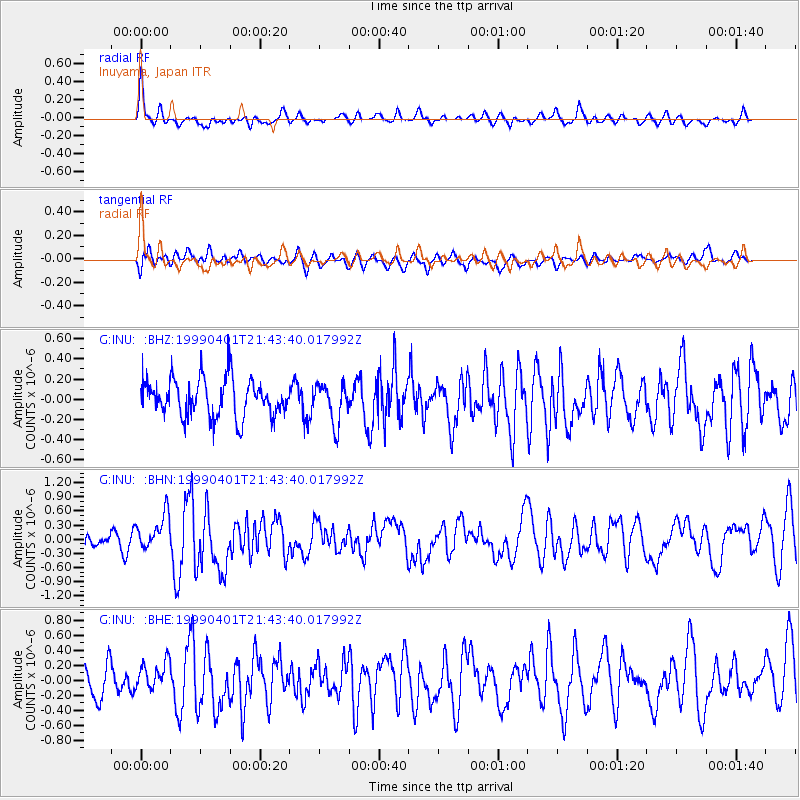
INU Inuyama, Japan - Earthquake Result Viewer
*The percent match for this event was below the threshold and hence no stack was calculated.
| Earthquake location: |
New Britain Region, P.N.G. |
| Earthquake latitude/longitude: |
-4.4/152.7 |
| Earthquake time(UTC): |
1999/04/01 (091) 21:36:21 GMT |
| Earthquake Depth: |
33 km |
| Earthquake Magnitude: |
5.6 MB, 6.1 MS, 6.3 MW, 6.1 MW |
| Earthquake Catalog/Contributor: |
WHDF/NEIC |
|
| Network: |
G GEOSCOPE |
| Station: |
INU Inuyama, Japan |
| Lat/Lon: |
35.35 N/137.03 E |
| Elevation: |
132 m |
|
| Distance: |
42.2 deg |
| Az: |
340.783 deg |
| Baz: |
156.328 deg |
| Ray Param: |
$rayparam |
*The percent match for this event was below the threshold and hence was not used in the summary stack. |
|
| Radial Match: |
68.994545 % |
| Radial Bump: |
394 |
| Transverse Match: |
48.675873 % |
| Transverse Bump: |
400 |
| SOD ConfigId: |
4480 |
| Insert Time: |
2010-02-26 23:24:33.418 +0000 |
| GWidth: |
2.5 |
| Max Bumps: |
400 |
| Tol: |
0.001 |
|
Signal To Noise
| Channel | StoN | STA | LTA |
| G:INU: :BHN:19990401T21:43:40.017992Z | 2.8524072 | 3.772092E-7 | 1.322424E-7 |
| G:INU: :BHE:19990401T21:43:40.017992Z | 0.9452681 | 1.8550288E-7 | 1.9624366E-7 |
| G:INU: :BHZ:19990401T21:43:40.017992Z | 1.0463536 | 1.937877E-7 | 1.852029E-7 |
| Arrivals |
| Ps | |
| PpPs | |
| PsPs/PpSs | |


