You are here: Home > Network List > TA - USArray Transportable Network (new EarthScope stations) Stations List
> Station I39A Houston, MN, USA > Earthquake Result Viewer
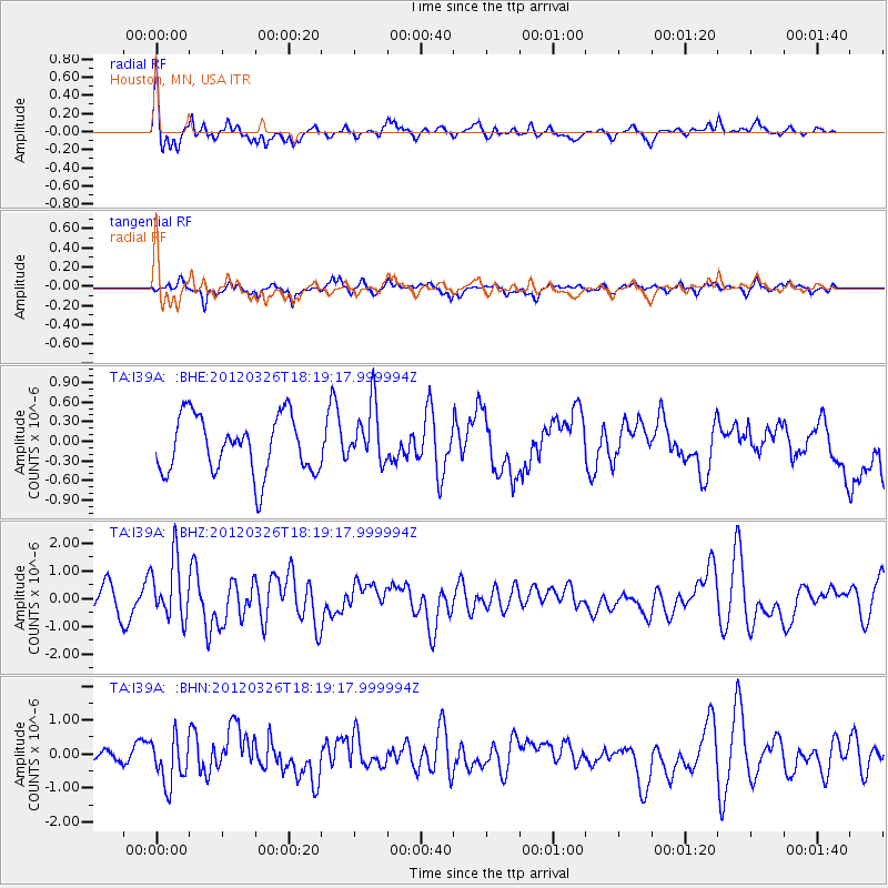
I39A Houston, MN, USA - Earthquake Result Viewer
*The percent match for this event was below the threshold and hence no stack was calculated.
| Earthquake location: |
Northern East Pacific Rise |
| Earthquake latitude/longitude: |
10.1/-104.2 |
| Earthquake time(UTC): |
2012/03/26 (086) 18:12:52 GMT |
| Earthquake Depth: |
10 km |
| Earthquake Magnitude: |
5.6 MB, 5.8 MS, 6.0 MW, 6.0 MW |
| Earthquake Catalog/Contributor: |
WHDF/NEIC |
|
| Network: |
TA USArray Transportable Network (new EarthScope stations) |
| Station: |
I39A Houston, MN, USA |
| Lat/Lon: |
43.85 N/91.52 W |
| Elevation: |
393 m |
|
| Distance: |
35.4 deg |
| Az: |
15.855 deg |
| Baz: |
201.833 deg |
| Ray Param: |
$rayparam |
*The percent match for this event was below the threshold and hence was not used in the summary stack. |
|
| Radial Match: |
75.5972 % |
| Radial Bump: |
400 |
| Transverse Match: |
49.396957 % |
| Transverse Bump: |
385 |
| SOD ConfigId: |
440406 |
| Insert Time: |
2012-06-08 07:04:34.453 +0000 |
| GWidth: |
2.5 |
| Max Bumps: |
400 |
| Tol: |
0.001 |
|
Signal To Noise
| Channel | StoN | STA | LTA |
| TA:I39A: :BHZ:20120326T18:19:17.999994Z | 2.385282 | 1.071755E-6 | 4.4932005E-7 |
| TA:I39A: :BHN:20120326T18:19:17.999994Z | 2.3666058 | 6.695337E-7 | 2.8290884E-7 |
| TA:I39A: :BHE:20120326T18:19:17.999994Z | 1.0357038 | 4.473698E-7 | 4.3194765E-7 |
| Arrivals |
| Ps | |
| PpPs | |
| PsPs/PpSs | |


