You are here: Home > Network List > G - GEOSCOPE Stations List
> Station INU Inuyama, Japan > Earthquake Result Viewer
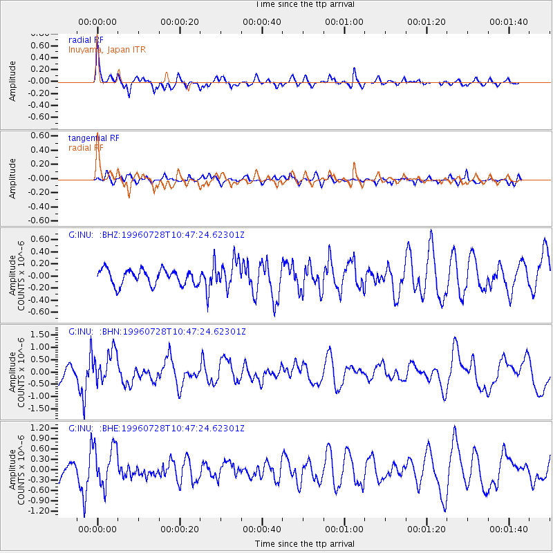
INU Inuyama, Japan - Earthquake Result Viewer
*The percent match for this event was below the threshold and hence no stack was calculated.
| Earthquake location: |
Minahassa Peninsula, Sulawesi |
| Earthquake latitude/longitude: |
1.0/120.2 |
| Earthquake time(UTC): |
1996/07/28 (210) 10:40:43 GMT |
| Earthquake Depth: |
33 km |
| Earthquake Magnitude: |
5.5 MB, 5.5 MS, 6.0 UNKNOWN, 5.9 MW |
| Earthquake Catalog/Contributor: |
WHDF/NEIC |
|
| Network: |
G GEOSCOPE |
| Station: |
INU Inuyama, Japan |
| Lat/Lon: |
35.35 N/137.03 E |
| Elevation: |
132 m |
|
| Distance: |
37.6 deg |
| Az: |
22.832 deg |
| Baz: |
208.334 deg |
| Ray Param: |
$rayparam |
*The percent match for this event was below the threshold and hence was not used in the summary stack. |
|
| Radial Match: |
74.0006 % |
| Radial Bump: |
400 |
| Transverse Match: |
64.44393 % |
| Transverse Bump: |
400 |
| SOD ConfigId: |
4480 |
| Insert Time: |
2010-02-26 23:24:48.417 +0000 |
| GWidth: |
2.5 |
| Max Bumps: |
400 |
| Tol: |
0.001 |
|
Signal To Noise
| Channel | StoN | STA | LTA |
| G:INU: :BHN:19960728T10:47:24.62301Z | 2.0365684 | 6.566356E-7 | 3.2242255E-7 |
| G:INU: :BHE:19960728T10:47:24.62301Z | 2.6162632 | 5.89704E-7 | 2.2539933E-7 |
| G:INU: :BHZ:19960728T10:47:24.62301Z | 1.7457803 | 2.2028136E-7 | 1.2617932E-7 |
| Arrivals |
| Ps | |
| PpPs | |
| PsPs/PpSs | |


