You are here: Home > Network List > G - GEOSCOPE Stations List
> Station INU Inuyama, Japan > Earthquake Result Viewer
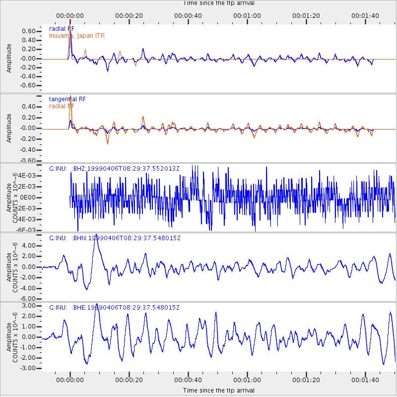
INU Inuyama, Japan - Earthquake Result Viewer
*The percent match for this event was below the threshold and hence no stack was calculated.
| Earthquake location: |
Eastern New Guinea Reg., P.N.G. |
| Earthquake latitude/longitude: |
-6.5/147.0 |
| Earthquake time(UTC): |
1999/04/06 (096) 08:22:14 GMT |
| Earthquake Depth: |
33 km |
| Earthquake Magnitude: |
5.8 MB, 6.3 MS, 6.3 MW, 6.2 MW |
| Earthquake Catalog/Contributor: |
WHDF/NEIC |
|
| Network: |
G GEOSCOPE |
| Station: |
INU Inuyama, Japan |
| Lat/Lon: |
35.35 N/137.03 E |
| Elevation: |
132 m |
|
| Distance: |
42.7 deg |
| Az: |
347.945 deg |
| Baz: |
165.294 deg |
| Ray Param: |
$rayparam |
*The percent match for this event was below the threshold and hence was not used in the summary stack. |
|
| Radial Match: |
72.98319 % |
| Radial Bump: |
393 |
| Transverse Match: |
72.924355 % |
| Transverse Bump: |
400 |
| SOD ConfigId: |
4480 |
| Insert Time: |
2010-02-26 23:24:52.335 +0000 |
| GWidth: |
2.5 |
| Max Bumps: |
400 |
| Tol: |
0.001 |
|
Signal To Noise
| Channel | StoN | STA | LTA |
| G:INU: :BHN:19990406T08:29:37.548015Z | 4.984036 | 1.4618441E-6 | 2.933053E-7 |
| G:INU: :BHE:19990406T08:29:37.548015Z | 2.3199413 | 7.8830635E-7 | 3.397958E-7 |
| G:INU: :BHZ:19990406T08:29:37.552013Z | 1.0844841 | 2.1334055E-9 | 1.9672077E-9 |
| Arrivals |
| Ps | |
| PpPs | |
| PsPs/PpSs | |


