You are here: Home > Network List > TA - USArray Transportable Network (new EarthScope stations) Stations List
> Station E45A Wooded Hills, Hulbert, MI, USA > Earthquake Result Viewer
E45A Wooded Hills, Hulbert, MI, USA - Earthquake Result Viewer

| Earthquake location: |
Northern East Pacific Rise |
| Earthquake latitude/longitude: |
10.1/-104.2 |
| Earthquake time(UTC): |
2012/03/26 (086) 18:12:52 GMT |
| Earthquake Depth: |
10 km |
| Earthquake Magnitude: |
5.6 MB, 5.8 MS, 6.0 MW, 6.0 MW |
| Earthquake Catalog/Contributor: |
WHDF/NEIC |
|
| Network: |
TA USArray Transportable Network (new EarthScope stations) |
| Station: |
E45A Wooded Hills, Hulbert, MI, USA |
| Lat/Lon: |
46.36 N/85.18 W |
| Elevation: |
251 m |
|
| Distance: |
39.6 deg |
| Az: |
20.688 deg |
| Baz: |
210.154 deg |
| Ray Param: |
0.07487905 |
| Estimated Moho Depth: |
36.0 km |
| Estimated Crust Vp/Vs: |
2.10 |
| Assumed Crust Vp: |
6.467 km/s |
| Estimated Crust Vs: |
3.083 km/s |
| Estimated Crust Poisson's Ratio: |
0.35 |
|
| Radial Match: |
80.04399 % |
| Radial Bump: |
391 |
| Transverse Match: |
54.18383 % |
| Transverse Bump: |
400 |
| SOD ConfigId: |
440406 |
| Insert Time: |
2012-06-08 07:07:23.831 +0000 |
| GWidth: |
2.5 |
| Max Bumps: |
400 |
| Tol: |
0.001 |
|
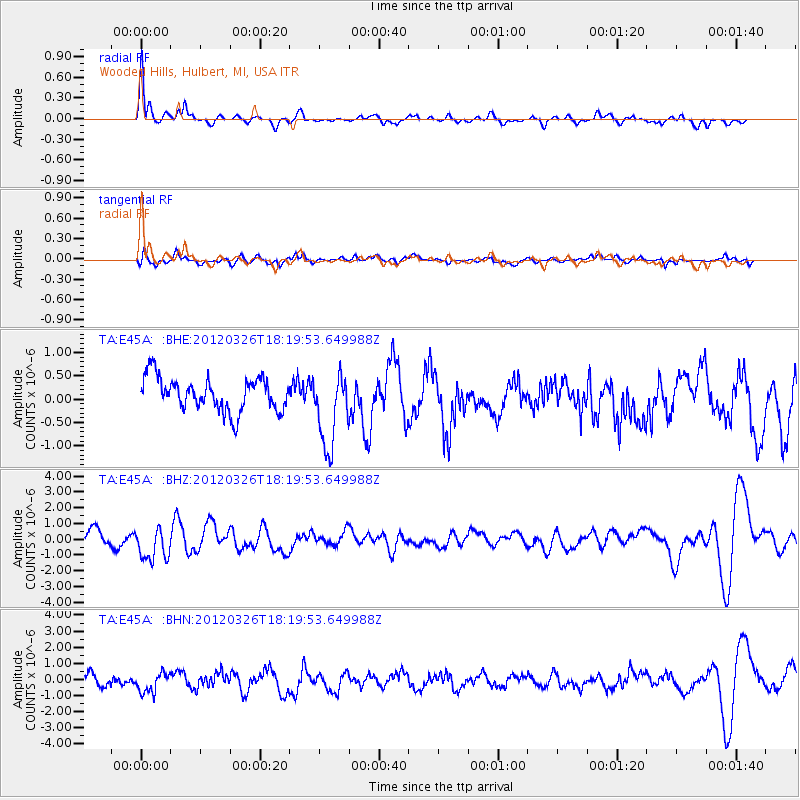
Signal To Noise
| Channel | StoN | STA | LTA |
| TA:E45A: :BHZ:20120326T18:19:53.649988Z | 2.744109 | 1.0375895E-6 | 3.781153E-7 |
| TA:E45A: :BHN:20120326T18:19:53.649988Z | 1.4468791 | 6.0122795E-7 | 4.1553434E-7 |
| TA:E45A: :BHE:20120326T18:19:53.649988Z | 2.2917755 | 8.1488827E-7 | 3.555707E-7 |
| Arrivals |
| Ps | 6.5 SECOND |
| PpPs | 16 SECOND |
| PsPs/PpSs | 23 SECOND |


