You are here: Home > Network List > G - GEOSCOPE Stations List
> Station INU Inuyama, Japan > Earthquake Result Viewer
INU Inuyama, Japan - Earthquake Result Viewer
*The percent match for this event was below the threshold and hence no stack was calculated.
| Earthquake location: |
Samoa Islands Region |
| Earthquake latitude/longitude: |
-14.9/-175.1 |
| Earthquake time(UTC): |
1991/04/19 (109) 11:25:35 GMT |
| Earthquake Depth: |
33 km |
| Earthquake Magnitude: |
5.6 MB, 6.0 MS, 5.8 UNKNOWN |
| Earthquake Catalog/Contributor: |
WHDF/NEIC |
|
| Network: |
G GEOSCOPE |
| Station: |
INU Inuyama, Japan |
| Lat/Lon: |
35.35 N/137.03 E |
| Elevation: |
132 m |
|
| Distance: |
67.5 deg |
| Az: |
319.017 deg |
| Baz: |
129.143 deg |
| Ray Param: |
$rayparam |
*The percent match for this event was below the threshold and hence was not used in the summary stack. |
|
| Radial Match: |
56.027447 % |
| Radial Bump: |
400 |
| Transverse Match: |
66.224205 % |
| Transverse Bump: |
389 |
| SOD ConfigId: |
4480 |
| Insert Time: |
2010-02-26 23:24:56.624 +0000 |
| GWidth: |
2.5 |
| Max Bumps: |
400 |
| Tol: |
0.001 |
|
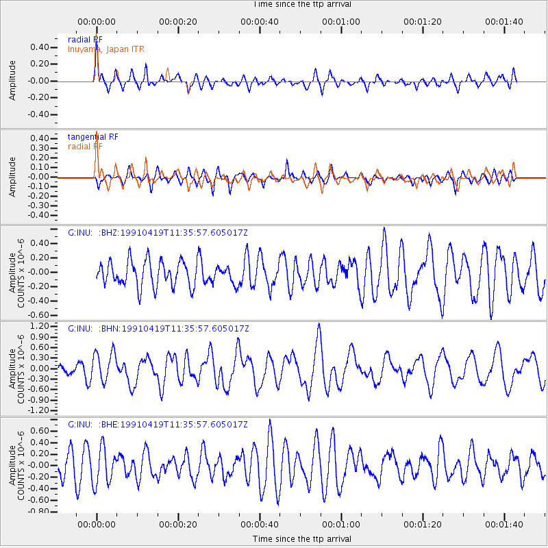
Signal To Noise
| Channel | StoN | STA | LTA |
| G:INU: :BHN:19910419T11:35:57.605017Z | 2.5303066 | 4.2935815E-7 | 1.6968622E-7 |
| G:INU: :BHE:19910419T11:35:57.605017Z | 1.2571143 | 3.186842E-7 | 2.5350454E-7 |
| G:INU: :BHZ:19910419T11:35:57.605017Z | 0.6570707 | 1.1566201E-7 | 1.7602673E-7 |
| Arrivals |
| Ps | |
| PpPs | |
| PsPs/PpSs | |


