You are here: Home > Network List > G - GEOSCOPE Stations List
> Station INU Inuyama, Japan > Earthquake Result Viewer
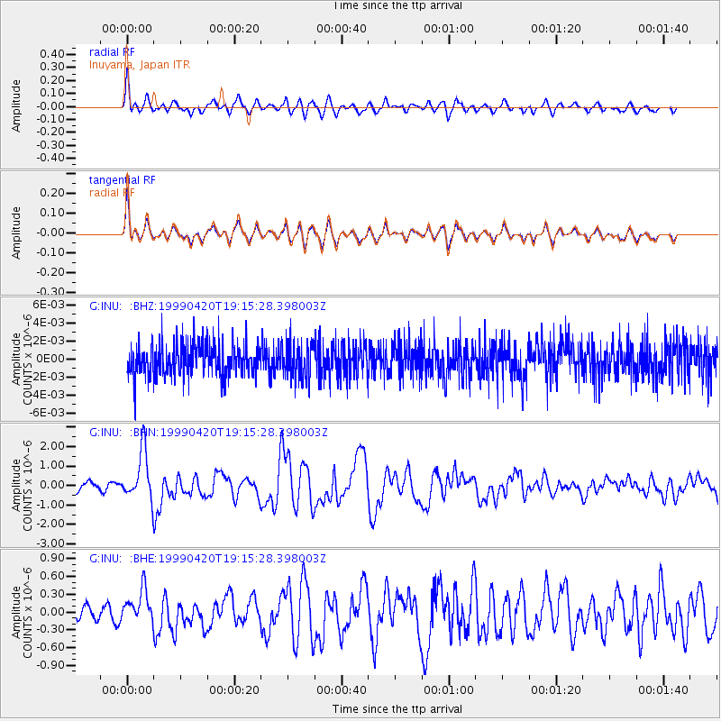
INU Inuyama, Japan - Earthquake Result Viewer
*The percent match for this event was below the threshold and hence no stack was calculated.
| Earthquake location: |
Kermadec Islands Region |
| Earthquake latitude/longitude: |
-31.9/-179.0 |
| Earthquake time(UTC): |
1999/04/20 (110) 19:04:08 GMT |
| Earthquake Depth: |
96 km |
| Earthquake Magnitude: |
6.2 MB, 6.5 MW, 6.5 MW |
| Earthquake Catalog/Contributor: |
WHDF/NEIC |
|
| Network: |
G GEOSCOPE |
| Station: |
INU Inuyama, Japan |
| Lat/Lon: |
35.35 N/137.03 E |
| Elevation: |
132 m |
|
| Distance: |
78.6 deg |
| Az: |
324.648 deg |
| Baz: |
142.979 deg |
| Ray Param: |
$rayparam |
*The percent match for this event was below the threshold and hence was not used in the summary stack. |
|
| Radial Match: |
85.457504 % |
| Radial Bump: |
400 |
| Transverse Match: |
85.39401 % |
| Transverse Bump: |
400 |
| SOD ConfigId: |
4480 |
| Insert Time: |
2010-02-26 23:24:58.198 +0000 |
| GWidth: |
2.5 |
| Max Bumps: |
400 |
| Tol: |
0.001 |
|
Signal To Noise
| Channel | StoN | STA | LTA |
| G:INU: :BHN:19990420T19:15:28.398003Z | 6.245826 | 1.2769862E-6 | 2.0445432E-7 |
| G:INU: :BHE:19990420T19:15:28.398003Z | 2.2055306 | 2.865369E-7 | 1.2991745E-7 |
| G:INU: :BHZ:19990420T19:15:28.398003Z | 1.1265675 | 1.9722448E-9 | 1.7506674E-9 |
| Arrivals |
| Ps | |
| PpPs | |
| PsPs/PpSs | |


