You are here: Home > Network List > TA - USArray Transportable Network (new EarthScope stations) Stations List
> Station H38A Maiden Rock, WI, USA > Earthquake Result Viewer
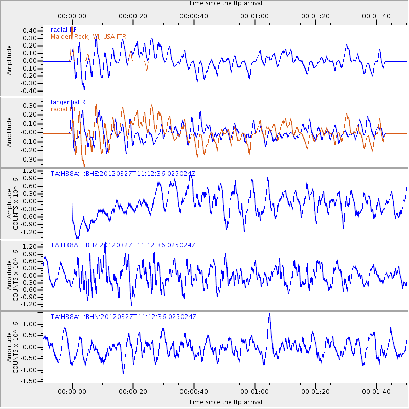
H38A Maiden Rock, WI, USA - Earthquake Result Viewer
*The percent match for this event was below the threshold and hence no stack was calculated.
| Earthquake location: |
Near East Coast Of Honshu, Japan |
| Earthquake latitude/longitude: |
39.9/142.0 |
| Earthquake time(UTC): |
2012/03/27 (087) 11:00:44 GMT |
| Earthquake Depth: |
15 km |
| Earthquake Magnitude: |
6.0 MB, 5.7 MS, 6.1 MW, 5.9 MW |
| Earthquake Catalog/Contributor: |
WHDF/NEIC |
|
| Network: |
TA USArray Transportable Network (new EarthScope stations) |
| Station: |
H38A Maiden Rock, WI, USA |
| Lat/Lon: |
44.68 N/92.28 W |
| Elevation: |
333 m |
|
| Distance: |
82.7 deg |
| Az: |
35.739 deg |
| Baz: |
320.937 deg |
| Ray Param: |
$rayparam |
*The percent match for this event was below the threshold and hence was not used in the summary stack. |
|
| Radial Match: |
29.492249 % |
| Radial Bump: |
400 |
| Transverse Match: |
59.61056 % |
| Transverse Bump: |
400 |
| SOD ConfigId: |
440406 |
| Insert Time: |
2012-06-08 07:57:06.183 +0000 |
| GWidth: |
2.5 |
| Max Bumps: |
400 |
| Tol: |
0.001 |
|
Signal To Noise
| Channel | StoN | STA | LTA |
| TA:H38A: :BHZ:20120327T11:12:36.025024Z | 1.0967292 | 3.741388E-7 | 3.411406E-7 |
| TA:H38A: :BHN:20120327T11:12:36.025024Z | 1.6800063 | 6.844206E-7 | 4.073917E-7 |
| TA:H38A: :BHE:20120327T11:12:36.025024Z | 2.4715712 | 9.3236645E-7 | 3.7723635E-7 |
| Arrivals |
| Ps | |
| PpPs | |
| PsPs/PpSs | |


