You are here: Home > Network List > G - GEOSCOPE Stations List
> Station INU Inuyama, Japan > Earthquake Result Viewer
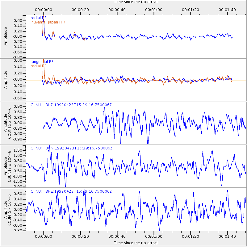
INU Inuyama, Japan - Earthquake Result Viewer
*The percent match for this event was below the threshold and hence no stack was calculated.
| Earthquake location: |
Myanmar-China Border Region |
| Earthquake latitude/longitude: |
22.4/98.9 |
| Earthquake time(UTC): |
1992/04/23 (114) 15:32:52 GMT |
| Earthquake Depth: |
33 km |
| Earthquake Magnitude: |
5.9 MB, 6.3 MS |
| Earthquake Catalog/Contributor: |
WHDF/NEIC |
|
| Network: |
G GEOSCOPE |
| Station: |
INU Inuyama, Japan |
| Lat/Lon: |
35.35 N/137.03 E |
| Elevation: |
132 m |
|
| Distance: |
35.6 deg |
| Az: |
60.139 deg |
| Baz: |
259.126 deg |
| Ray Param: |
$rayparam |
*The percent match for this event was below the threshold and hence was not used in the summary stack. |
|
| Radial Match: |
75.76625 % |
| Radial Bump: |
400 |
| Transverse Match: |
55.067635 % |
| Transverse Bump: |
400 |
| SOD ConfigId: |
4480 |
| Insert Time: |
2010-02-26 23:25:06.491 +0000 |
| GWidth: |
2.5 |
| Max Bumps: |
400 |
| Tol: |
0.001 |
|
Signal To Noise
| Channel | StoN | STA | LTA |
| G:INU: :BHN:19920423T15:39:16.750006Z | 4.313421 | 1.0232436E-6 | 2.3722325E-7 |
| G:INU: :BHE:19920423T15:39:16.750006Z | 1.8989079 | 3.1008904E-7 | 1.6329862E-7 |
| G:INU: :BHZ:19920423T15:39:16.750006Z | 2.2607563 | 4.3983036E-7 | 1.945501E-7 |
| Arrivals |
| Ps | |
| PpPs | |
| PsPs/PpSs | |


