You are here: Home > Network List > TA - USArray Transportable Network (new EarthScope stations) Stations List
> Station C38A Sawbill Landing (USFS), Superior Nat. Forest, MN, > Earthquake Result Viewer
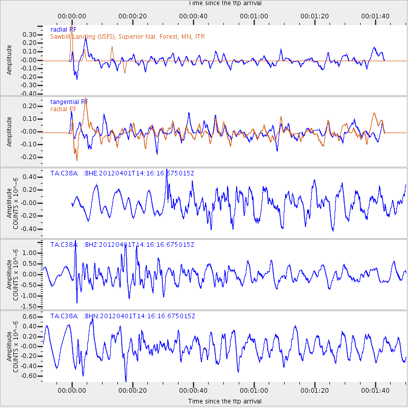
C38A Sawbill Landing (USFS), Superior Nat. Forest, MN, - Earthquake Result Viewer
*The percent match for this event was below the threshold and hence no stack was calculated.
| Earthquake location: |
Eastern Honshu, Japan |
| Earthquake latitude/longitude: |
37.1/141.0 |
| Earthquake time(UTC): |
2012/04/01 (092) 14:04:24 GMT |
| Earthquake Depth: |
48 km |
| Earthquake Magnitude: |
5.8 MB, 5.2 MS, 5.7 MW, 5.7 MW |
| Earthquake Catalog/Contributor: |
WHDF/NEIC |
|
| Network: |
TA USArray Transportable Network (new EarthScope stations) |
| Station: |
C38A Sawbill Landing (USFS), Superior Nat. Forest, MN, |
| Lat/Lon: |
47.72 N/91.27 W |
| Elevation: |
498 m |
|
| Distance: |
83.5 deg |
| Az: |
32.493 deg |
| Baz: |
320.512 deg |
| Ray Param: |
$rayparam |
*The percent match for this event was below the threshold and hence was not used in the summary stack. |
|
| Radial Match: |
58.46122 % |
| Radial Bump: |
400 |
| Transverse Match: |
55.93614 % |
| Transverse Bump: |
400 |
| SOD ConfigId: |
445498 |
| Insert Time: |
2012-06-23 03:54:38.414 +0000 |
| GWidth: |
2.5 |
| Max Bumps: |
400 |
| Tol: |
0.001 |
|
Signal To Noise
| Channel | StoN | STA | LTA |
| TA:C38A: :BHZ:20120401T14:16:16.675015Z | 2.9203715 | 5.482124E-7 | 1.877201E-7 |
| TA:C38A: :BHN:20120401T14:16:16.675015Z | 2.0333018 | 3.065701E-7 | 1.5077451E-7 |
| TA:C38A: :BHE:20120401T14:16:16.675015Z | 1.371595 | 1.7892948E-7 | 1.3045357E-7 |
| Arrivals |
| Ps | |
| PpPs | |
| PsPs/PpSs | |


