You are here: Home > Network List > TA - USArray Transportable Network (new EarthScope stations) Stations List
> Station S40A Lebanon, MO, USA > Earthquake Result Viewer
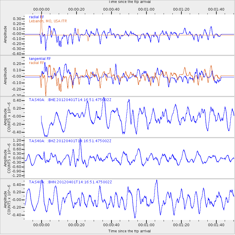
S40A Lebanon, MO, USA - Earthquake Result Viewer
*The percent match for this event was below the threshold and hence no stack was calculated.
| Earthquake location: |
Eastern Honshu, Japan |
| Earthquake latitude/longitude: |
37.1/141.0 |
| Earthquake time(UTC): |
2012/04/01 (092) 14:04:24 GMT |
| Earthquake Depth: |
48 km |
| Earthquake Magnitude: |
5.8 MB, 5.2 MS, 5.7 MW, 5.7 MW |
| Earthquake Catalog/Contributor: |
WHDF/NEIC |
|
| Network: |
TA USArray Transportable Network (new EarthScope stations) |
| Station: |
S40A Lebanon, MO, USA |
| Lat/Lon: |
37.60 N/92.50 W |
| Elevation: |
336 m |
|
| Distance: |
90.7 deg |
| Az: |
39.657 deg |
| Baz: |
320.038 deg |
| Ray Param: |
$rayparam |
*The percent match for this event was below the threshold and hence was not used in the summary stack. |
|
| Radial Match: |
54.794353 % |
| Radial Bump: |
400 |
| Transverse Match: |
49.317265 % |
| Transverse Bump: |
400 |
| SOD ConfigId: |
445498 |
| Insert Time: |
2012-06-23 03:57:21.921 +0000 |
| GWidth: |
2.5 |
| Max Bumps: |
400 |
| Tol: |
0.001 |
|
Signal To Noise
| Channel | StoN | STA | LTA |
| TA:S40A: :BHZ:20120401T14:16:51.475002Z | 0.884806 | 1.8396996E-7 | 2.0792125E-7 |
| TA:S40A: :BHN:20120401T14:16:51.475002Z | 1.8833047 | 2.9570919E-7 | 1.570161E-7 |
| TA:S40A: :BHE:20120401T14:16:51.475002Z | 0.6735336 | 1.3087339E-7 | 1.9430863E-7 |
| Arrivals |
| Ps | |
| PpPs | |
| PsPs/PpSs | |


