You are here: Home > Network List > G - GEOSCOPE Stations List
> Station INU Inuyama, Japan > Earthquake Result Viewer
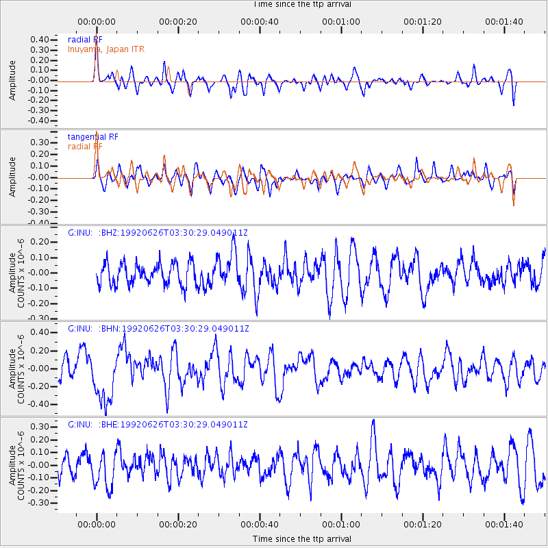
INU Inuyama, Japan - Earthquake Result Viewer
*The percent match for this event was below the threshold and hence no stack was calculated.
| Earthquake location: |
South Of Kermadec Islands |
| Earthquake latitude/longitude: |
-33.7/-179.1 |
| Earthquake time(UTC): |
1992/06/26 (178) 03:18:54 GMT |
| Earthquake Depth: |
33 km |
| Earthquake Magnitude: |
5.6 MB, 5.7 MS |
| Earthquake Catalog/Contributor: |
WHDF/NEIC |
|
| Network: |
G GEOSCOPE |
| Station: |
INU Inuyama, Japan |
| Lat/Lon: |
35.35 N/137.03 E |
| Elevation: |
132 m |
|
| Distance: |
80.0 deg |
| Az: |
324.867 deg |
| Baz: |
144.055 deg |
| Ray Param: |
$rayparam |
*The percent match for this event was below the threshold and hence was not used in the summary stack. |
|
| Radial Match: |
63.578533 % |
| Radial Bump: |
400 |
| Transverse Match: |
58.96743 % |
| Transverse Bump: |
400 |
| SOD ConfigId: |
4480 |
| Insert Time: |
2010-02-26 23:25:27.183 +0000 |
| GWidth: |
2.5 |
| Max Bumps: |
400 |
| Tol: |
0.001 |
|
Signal To Noise
| Channel | StoN | STA | LTA |
| G:INU: :BHN:19920626T03:30:29.049011Z | 3.1889973 | 2.9624763E-7 | 9.289679E-8 |
| G:INU: :BHE:19920626T03:30:29.049011Z | 2.097363 | 1.4335342E-7 | 6.834936E-8 |
| G:INU: :BHZ:19920626T03:30:29.049011Z | 1.6731954 | 1.1471838E-7 | 6.856246E-8 |
| Arrivals |
| Ps | |
| PpPs | |
| PsPs/PpSs | |


