You are here: Home > Network List > G - GEOSCOPE Stations List
> Station INU Inuyama, Japan > Earthquake Result Viewer
INU Inuyama, Japan - Earthquake Result Viewer
*The percent match for this event was below the threshold and hence no stack was calculated.
| Earthquake location: |
South Of Fiji Islands |
| Earthquake latitude/longitude: |
-22.4/-178.1 |
| Earthquake time(UTC): |
1992/11/12 (317) 22:28:58 GMT |
| Earthquake Depth: |
368 km |
| Earthquake Magnitude: |
5.9 MB |
| Earthquake Catalog/Contributor: |
WHDF/NEIC |
|
| Network: |
G GEOSCOPE |
| Station: |
INU Inuyama, Japan |
| Lat/Lon: |
35.35 N/137.03 E |
| Elevation: |
132 m |
|
| Distance: |
71.4 deg |
| Az: |
322.515 deg |
| Baz: |
136.435 deg |
| Ray Param: |
$rayparam |
*The percent match for this event was below the threshold and hence was not used in the summary stack. |
|
| Radial Match: |
68.242485 % |
| Radial Bump: |
400 |
| Transverse Match: |
61.078434 % |
| Transverse Bump: |
400 |
| SOD ConfigId: |
4480 |
| Insert Time: |
2010-02-26 23:25:39.206 +0000 |
| GWidth: |
2.5 |
| Max Bumps: |
400 |
| Tol: |
0.001 |
|
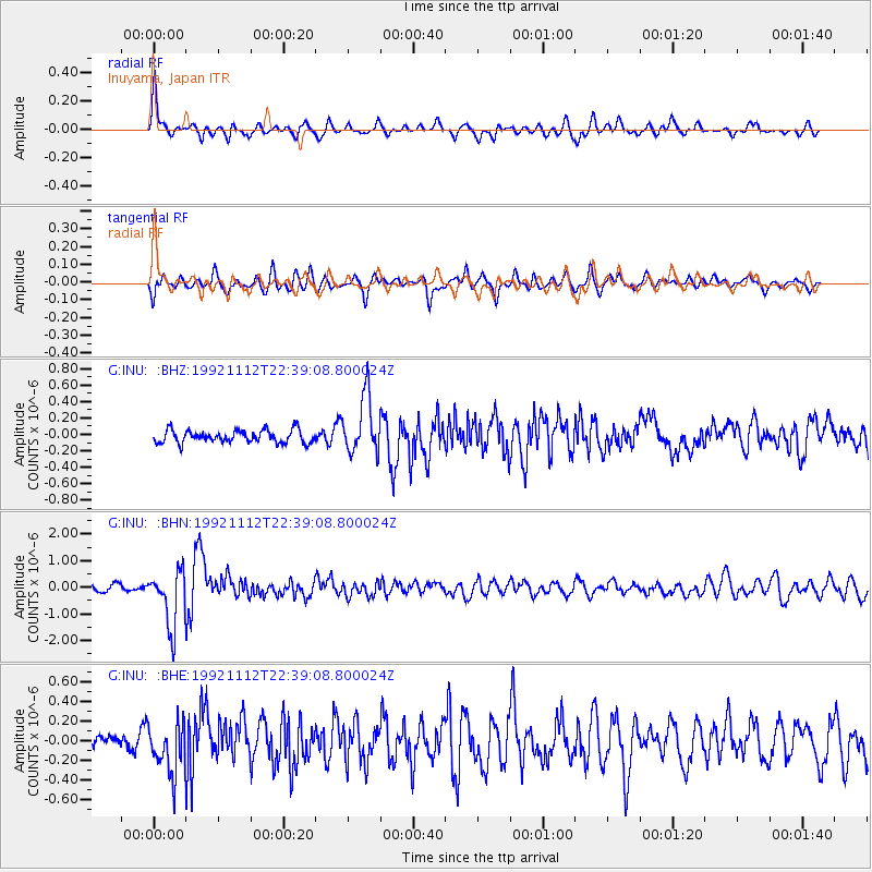
Signal To Noise
| Channel | StoN | STA | LTA |
| G:INU: :BHN:19921112T22:39:08.800024Z | 6.309637 | 1.0704314E-6 | 1.6965024E-7 |
| G:INU: :BHE:19921112T22:39:08.800024Z | 1.4662858 | 2.509635E-7 | 1.7115592E-7 |
| G:INU: :BHZ:19921112T22:39:08.800024Z | 4.623216 | 3.511884E-7 | 7.596192E-8 |
| Arrivals |
| Ps | |
| PpPs | |
| PsPs/PpSs | |


