You are here: Home > Network List > G - GEOSCOPE Stations List
> Station INU Inuyama, Japan > Earthquake Result Viewer
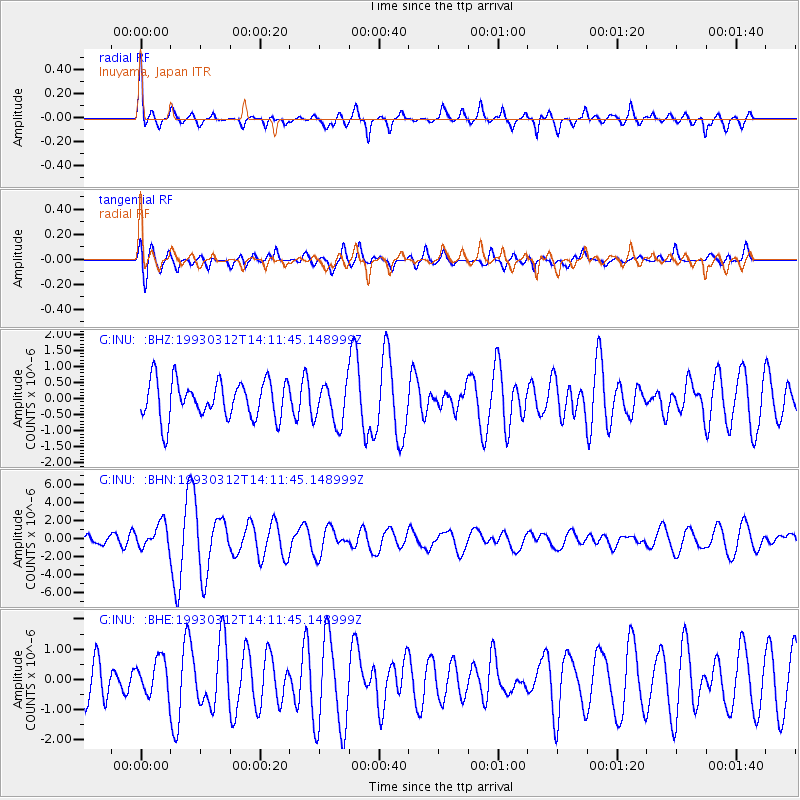
INU Inuyama, Japan - Earthquake Result Viewer
*The percent match for this event was below the threshold and hence no stack was calculated.
| Earthquake location: |
Fiji Islands Region |
| Earthquake latitude/longitude: |
-14.3/-178.3 |
| Earthquake time(UTC): |
1993/03/12 (071) 14:01:38 GMT |
| Earthquake Depth: |
33 km |
| Earthquake Magnitude: |
5.9 MB, 6.5 MS |
| Earthquake Catalog/Contributor: |
WHDF/NEIC |
|
| Network: |
G GEOSCOPE |
| Station: |
INU Inuyama, Japan |
| Lat/Lon: |
35.35 N/137.03 E |
| Elevation: |
132 m |
|
| Distance: |
65.1 deg |
| Az: |
320.669 deg |
| Baz: |
131.284 deg |
| Ray Param: |
$rayparam |
*The percent match for this event was below the threshold and hence was not used in the summary stack. |
|
| Radial Match: |
74.95818 % |
| Radial Bump: |
400 |
| Transverse Match: |
64.19336 % |
| Transverse Bump: |
400 |
| SOD ConfigId: |
4480 |
| Insert Time: |
2010-02-26 23:25:59.568 +0000 |
| GWidth: |
2.5 |
| Max Bumps: |
400 |
| Tol: |
0.001 |
|
Signal To Noise
| Channel | StoN | STA | LTA |
| G:INU: :BHN:19930312T14:11:45.148999Z | 2.134489 | 1.3759621E-6 | 6.446331E-7 |
| G:INU: :BHE:19930312T14:11:45.148999Z | 0.7131545 | 6.0105793E-7 | 8.4281584E-7 |
| G:INU: :BHZ:19930312T14:11:45.148999Z | 1.0888158 | 6.396207E-7 | 5.874462E-7 |
| Arrivals |
| Ps | |
| PpPs | |
| PsPs/PpSs | |


