You are here: Home > Network List > GT - Global Telemetered Seismograph Network (USAF/USGS) Stations List
> Station PLCA Paso Flores, Argentina > Earthquake Result Viewer
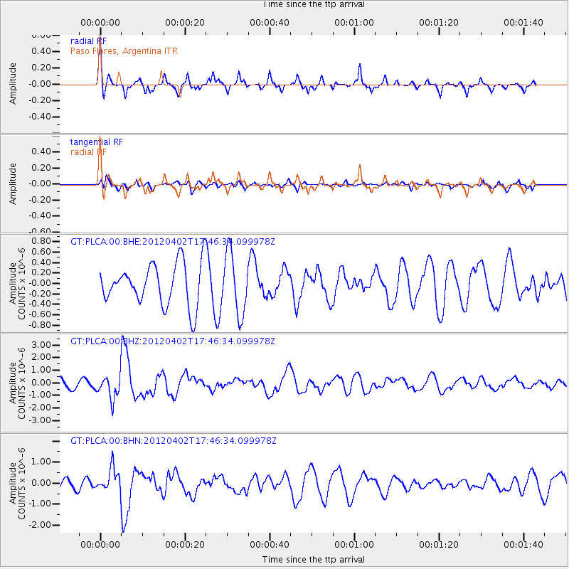
PLCA Paso Flores, Argentina - Earthquake Result Viewer
*The percent match for this event was below the threshold and hence no stack was calculated.
| Earthquake location: |
Near Coast Of Guerrero, Mexico |
| Earthquake latitude/longitude: |
16.4/-98.3 |
| Earthquake time(UTC): |
2012/04/02 (093) 17:36:42 GMT |
| Earthquake Depth: |
9.0 km |
| Earthquake Magnitude: |
5.8 MB, 5.9 MS, 6.0 MW, 6.0 MW |
| Earthquake Catalog/Contributor: |
WHDF/NEIC |
|
| Network: |
GT Global Telemetered Seismograph Network (USAF/USGS) |
| Station: |
PLCA Paso Flores, Argentina |
| Lat/Lon: |
40.73 S/70.55 W |
| Elevation: |
1050 m |
|
| Distance: |
62.4 deg |
| Az: |
156.458 deg |
| Baz: |
329.702 deg |
| Ray Param: |
$rayparam |
*The percent match for this event was below the threshold and hence was not used in the summary stack. |
|
| Radial Match: |
63.4869 % |
| Radial Bump: |
358 |
| Transverse Match: |
52.29691 % |
| Transverse Bump: |
400 |
| SOD ConfigId: |
445498 |
| Insert Time: |
2012-06-23 04:36:03.978 +0000 |
| GWidth: |
2.5 |
| Max Bumps: |
400 |
| Tol: |
0.001 |
|
Signal To Noise
| Channel | StoN | STA | LTA |
| GT:PLCA:00:BHZ:20120402T17:46:34.099978Z | 2.6328518 | 9.344583E-7 | 3.5492246E-7 |
| GT:PLCA:00:BHN:20120402T17:46:34.099978Z | 1.2330681 | 5.6210257E-7 | 4.5585685E-7 |
| GT:PLCA:00:BHE:20120402T17:46:34.099978Z | 1.4763106 | 5.9059533E-7 | 4.0004812E-7 |
| Arrivals |
| Ps | |
| PpPs | |
| PsPs/PpSs | |


