You are here: Home > Network List > G - GEOSCOPE Stations List
> Station INU Inuyama, Japan > Earthquake Result Viewer
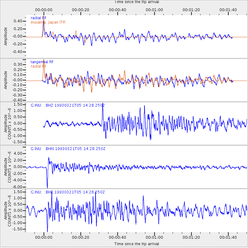
INU Inuyama, Japan - Earthquake Result Viewer
*The percent match for this event was below the threshold and hence no stack was calculated.
| Earthquake location: |
Fiji Islands Region |
| Earthquake latitude/longitude: |
-18.0/-178.5 |
| Earthquake time(UTC): |
1993/03/21 (080) 05:04:59 GMT |
| Earthquake Depth: |
584 km |
| Earthquake Magnitude: |
6.2 MB, 6.5 UNKNOWN |
| Earthquake Catalog/Contributor: |
WHDF/NEIC |
|
| Network: |
G GEOSCOPE |
| Station: |
INU Inuyama, Japan |
| Lat/Lon: |
35.35 N/137.03 E |
| Elevation: |
132 m |
|
| Distance: |
67.7 deg |
| Az: |
321.792 deg |
| Baz: |
133.929 deg |
| Ray Param: |
$rayparam |
*The percent match for this event was below the threshold and hence was not used in the summary stack. |
|
| Radial Match: |
75.277245 % |
| Radial Bump: |
400 |
| Transverse Match: |
69.48681 % |
| Transverse Bump: |
400 |
| SOD ConfigId: |
4480 |
| Insert Time: |
2010-02-26 23:26:03.263 +0000 |
| GWidth: |
2.5 |
| Max Bumps: |
400 |
| Tol: |
0.001 |
|
Signal To Noise
| Channel | StoN | STA | LTA |
| G:INU: :BHN:19930321T05:14:28.250Z | 16.52891 | 1.944442E-6 | 1.1763885E-7 |
| G:INU: :BHE:19930321T05:14:28.250Z | 3.7112453 | 5.884556E-7 | 1.5856014E-7 |
| G:INU: :BHZ:19930321T05:14:28.250Z | 5.284543 | 5.1897956E-7 | 9.820708E-8 |
| Arrivals |
| Ps | |
| PpPs | |
| PsPs/PpSs | |


