MDND Maddock, ND, USA - Earthquake Result Viewer
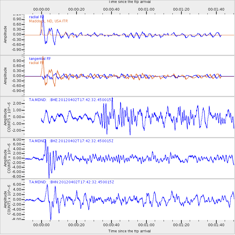
Earthquake location: Near Coast Of Guerrero, Mexico
Earthquake latitude/longitude: 16.4/-98.3
Earthquake time(UTC): 2012/04/02 (093) 17:36:42 GMT
Earthquake Depth: 9.0 km
Earthquake Magnitude: 5.8 MB, 5.9 MS, 6.0 MW, 6.0 MW
Earthquake Catalog/Contributor: WHDF/NEIC
Network: TA USArray Transportable Network (new EarthScope stations)
Station: MDND Maddock, ND, USA
Lat/Lon: 47.85 N/99.60 W
Elevation: 479 m
Distance: 31.4 deg
Az: 358.335 deg
Baz: 177.628 deg
Ray Param: 0.07908492
Estimated Moho Depth: 16.75 km
Estimated Crust Vp/Vs: 1.60
Assumed Crust Vp: 6.53 km/s
Estimated Crust Vs: 4.082 km/s
Estimated Crust Poisson's Ratio: 0.18
Radial Match: 89.04424 %
Radial Bump: 400
Transverse Match: 57.51322 %
Transverse Bump: 400
SOD ConfigId: 445498
Insert Time: 2012-06-23 04:41:23.874 +0000
GWidth: 2.5
Max Bumps: 400
Tol: 0.001

Signal To Noise

ChannelStoNSTALTA
TA:MDND: :BHZ:20120402T17:42:32.450015Z24.5114923.592615E-61.465686E-7
TA:MDND: :BHN:20120402T17:42:32.450015Z4.93131452.411702E-64.8905866E-7
TA:MDND: :BHE:20120402T17:42:32.450015Z1.38466566.133398E-74.4295157E-7
Arrivals
Ps1.7 SECOND
PpPs6.1 SECOND
PsPs/PpSs7.8 SECOND