You are here: Home > Network List > TA - USArray Transportable Network (new EarthScope stations) Stations List
> Station J05D Fort Rock, OR, USA > Earthquake Result Viewer
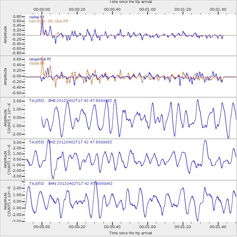
J05D Fort Rock, OR, USA - Earthquake Result Viewer
*The percent match for this event was below the threshold and hence no stack was calculated.
| Earthquake location: |
Near Coast Of Guerrero, Mexico |
| Earthquake latitude/longitude: |
16.4/-98.3 |
| Earthquake time(UTC): |
2012/04/02 (093) 17:36:42 GMT |
| Earthquake Depth: |
9.0 km |
| Earthquake Magnitude: |
5.8 MB, 5.9 MS, 6.0 MW, 6.0 MW |
| Earthquake Catalog/Contributor: |
WHDF/NEIC |
|
| Network: |
TA USArray Transportable Network (new EarthScope stations) |
| Station: |
J05D Fort Rock, OR, USA |
| Lat/Lon: |
43.28 N/121.23 W |
| Elevation: |
1541 m |
|
| Distance: |
33.2 deg |
| Az: |
328.665 deg |
| Baz: |
136.878 deg |
| Ray Param: |
$rayparam |
*The percent match for this event was below the threshold and hence was not used in the summary stack. |
|
| Radial Match: |
65.40374 % |
| Radial Bump: |
400 |
| Transverse Match: |
60.34388 % |
| Transverse Bump: |
304 |
| SOD ConfigId: |
445498 |
| Insert Time: |
2012-06-23 04:41:39.573 +0000 |
| GWidth: |
2.5 |
| Max Bumps: |
400 |
| Tol: |
0.001 |
|
Signal To Noise
| Channel | StoN | STA | LTA |
| TA:J05D: :BHZ:20120402T17:42:47.899996Z | 3.701938 | 1.9527904E-6 | 5.2750494E-7 |
| TA:J05D: :BHN:20120402T17:42:47.899996Z | 0.9401744 | 9.475228E-7 | 1.007816E-6 |
| TA:J05D: :BHE:20120402T17:42:47.899996Z | 1.1836177 | 1.1862148E-6 | 1.0021942E-6 |
| Arrivals |
| Ps | |
| PpPs | |
| PsPs/PpSs | |


