E31A Nome, ND, USA - Earthquake Result Viewer
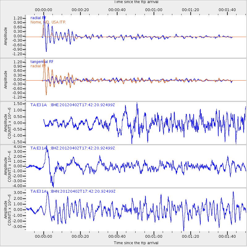
Earthquake location: Near Coast Of Guerrero, Mexico
Earthquake latitude/longitude: 16.4/-98.3
Earthquake time(UTC): 2012/04/02 (093) 17:36:42 GMT
Earthquake Depth: 9.0 km
Earthquake Magnitude: 5.8 MB, 5.9 MS, 6.0 MW, 6.0 MW
Earthquake Catalog/Contributor: WHDF/NEIC
Network: TA USArray Transportable Network (new EarthScope stations)
Station: E31A Nome, ND, USA
Lat/Lon: 46.56 N/97.89 W
Elevation: 427 m
Distance: 30.1 deg
Az: 0.589 deg
Baz: 180.82 deg
Ray Param: 0.0794281
Estimated Moho Depth: 26.75 km
Estimated Crust Vp/Vs: 2.10
Assumed Crust Vp: 6.498 km/s
Estimated Crust Vs: 3.098 km/s
Estimated Crust Poisson's Ratio: 0.35
Radial Match: 82.95487 %
Radial Bump: 400
Transverse Match: 70.316696 %
Transverse Bump: 400
SOD ConfigId: 445498
Insert Time: 2012-06-23 04:43:23.016 +0000
GWidth: 2.5
Max Bumps: 400
Tol: 0.001

Signal To Noise

ChannelStoNSTALTA
TA:E31A: :BHZ:20120402T17:42:20.92499Z14.7345112.2631134E-61.5359271E-7
TA:E31A: :BHN:20120402T17:42:20.92499Z5.1236931.4759196E-62.8805778E-7
TA:E31A: :BHE:20120402T17:42:20.92499Z1.22654632.5638454E-72.0902965E-7
Arrivals
Ps4.8 SECOND
PpPs12 SECOND
PsPs/PpSs17 SECOND