D36A Goodland, MN, USA - Earthquake Result Viewer
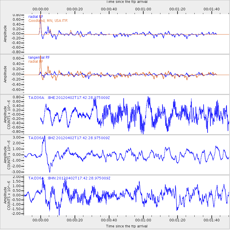
Earthquake location: Near Coast Of Guerrero, Mexico
Earthquake latitude/longitude: 16.4/-98.3
Earthquake time(UTC): 2012/04/02 (093) 17:36:42 GMT
Earthquake Depth: 9.0 km
Earthquake Magnitude: 5.8 MB, 5.9 MS, 6.0 MW, 6.0 MW
Earthquake Catalog/Contributor: WHDF/NEIC
Network: TA USArray Transportable Network (new EarthScope stations)
Station: D36A Goodland, MN, USA
Lat/Lon: 47.18 N/93.16 W
Elevation: 434 m
Distance: 31.0 deg
Az: 6.833 deg
Baz: 189.636 deg
Ray Param: 0.07918851
Estimated Moho Depth: 39.75 km
Estimated Crust Vp/Vs: 1.67
Assumed Crust Vp: 6.571 km/s
Estimated Crust Vs: 3.929 km/s
Estimated Crust Poisson's Ratio: 0.22
Radial Match: 85.17316 %
Radial Bump: 400
Transverse Match: 58.231346 %
Transverse Bump: 400
SOD ConfigId: 445498
Insert Time: 2012-06-23 04:44:40.918 +0000
GWidth: 2.5
Max Bumps: 400
Tol: 0.001

Signal To Noise

ChannelStoNSTALTA
TA:D36A: :BHZ:20120402T17:42:28.975009Z6.179221.6007805E-62.5905865E-7
TA:D36A: :BHN:20120402T17:42:28.975009Z4.52794088.689832E-71.9191576E-7
TA:D36A: :BHE:20120402T17:42:28.975009Z1.61041643.9563318E-72.4567134E-7
Arrivals
Ps4.4 SECOND
PpPs15 SECOND
PsPs/PpSs19 SECOND